You are here: Home > Network List > KN - Kyrgyz Seismic Telemetry Network Stations List
> Station TKM2 KN.TKM2 > Earthquake Result Viewer
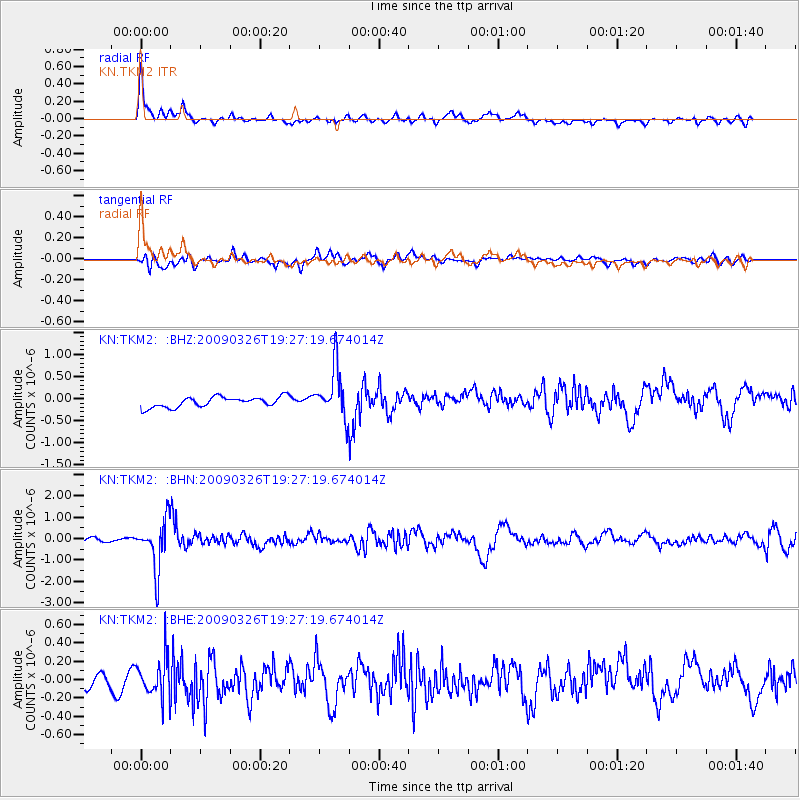
TKM2 KN.TKM2 - Earthquake Result Viewer
*The percent match for this event was below the threshold and hence no stack was calculated.
| Earthquake location: |
Northwest Of Ryukyu Islands |
| Earthquake latitude/longitude: |
27.4/126.7 |
| Earthquake time(UTC): |
2009/03/26 (085) 19:19:59 GMT |
| Earthquake Depth: |
160 km |
| Earthquake Magnitude: |
5.6 MB, 5.9 MW, 5.9 MW |
| Earthquake Catalog/Contributor: |
WHDF/NEIC |
|
| Network: |
KN Kyrgyz Seismic Telemetry Network |
| Station: |
TKM2 KN.TKM2 |
| Lat/Lon: |
42.92 N/75.60 E |
| Elevation: |
2020 m |
|
| Distance: |
43.9 deg |
| Az: |
304.432 deg |
| Baz: |
93.499 deg |
| Ray Param: |
$rayparam |
*The percent match for this event was below the threshold and hence was not used in the summary stack. |
|
| Radial Match: |
77.423965 % |
| Radial Bump: |
400 |
| Transverse Match: |
73.67736 % |
| Transverse Bump: |
400 |
| SOD ConfigId: |
2658 |
| Insert Time: |
2010-03-08 21:15:09.424 +0000 |
| GWidth: |
2.5 |
| Max Bumps: |
400 |
| Tol: |
0.001 |
|
Signal To Noise
| Channel | StoN | STA | LTA |
| KN:TKM2: :BHN:20090326T19:27:19.674014Z | 13.921254 | 1.1508212E-6 | 8.266648E-8 |
| KN:TKM2: :BHE:20090326T19:27:19.674014Z | 2.7521925 | 2.1712499E-7 | 7.8891645E-8 |
| KN:TKM2: :BHZ:20090326T19:27:19.674014Z | 4.9497805 | 5.7168927E-7 | 1.15497905E-7 |
| Arrivals |
| Ps | |
| PpPs | |
| PsPs/PpSs | |


