You are here: Home > Network List > KN - Kyrgyz Seismic Telemetry Network Stations List
> Station TKM2 KN.TKM2 > Earthquake Result Viewer
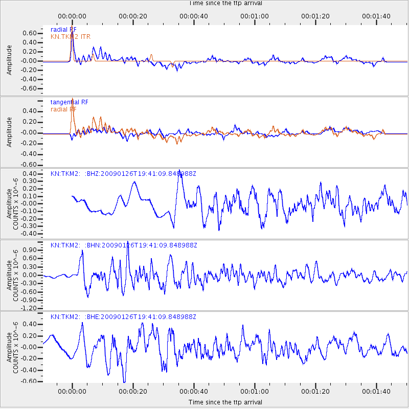
TKM2 KN.TKM2 - Earthquake Result Viewer
*The percent match for this event was below the threshold and hence no stack was calculated.
| Earthquake location: |
Southern Sumatra, Indonesia |
| Earthquake latitude/longitude: |
-0.4/98.2 |
| Earthquake time(UTC): |
2009/01/26 (026) 19:33:04 GMT |
| Earthquake Depth: |
10 km |
| Earthquake Magnitude: |
5.6 MW, 5.4 MB |
| Earthquake Catalog/Contributor: |
WHDF/NEIC |
|
| Network: |
KN Kyrgyz Seismic Telemetry Network |
| Station: |
TKM2 KN.TKM2 |
| Lat/Lon: |
42.92 N/75.60 E |
| Elevation: |
2020 m |
|
| Distance: |
47.6 deg |
| Az: |
337.545 deg |
| Baz: |
148.67 deg |
| Ray Param: |
$rayparam |
*The percent match for this event was below the threshold and hence was not used in the summary stack. |
|
| Radial Match: |
74.51451 % |
| Radial Bump: |
400 |
| Transverse Match: |
41.27742 % |
| Transverse Bump: |
400 |
| SOD ConfigId: |
2658 |
| Insert Time: |
2010-03-08 21:15:37.055 +0000 |
| GWidth: |
2.5 |
| Max Bumps: |
400 |
| Tol: |
0.001 |
|
Signal To Noise
| Channel | StoN | STA | LTA |
| KN:TKM2: :BHN:20090126T19:41:09.848988Z | 4.7050433 | 3.9244713E-7 | 8.340989E-8 |
| KN:TKM2: :BHE:20090126T19:41:09.848988Z | 1.6419209 | 2.0318483E-7 | 1.2374824E-7 |
| KN:TKM2: :BHZ:20090126T19:41:09.848988Z | 1.6647208 | 1.8719992E-7 | 1.1245124E-7 |
| Arrivals |
| Ps | |
| PpPs | |
| PsPs/PpSs | |


