You are here: Home > Network List > KN - Kyrgyz Seismic Telemetry Network Stations List
> Station TKM2 KN.TKM2 > Earthquake Result Viewer
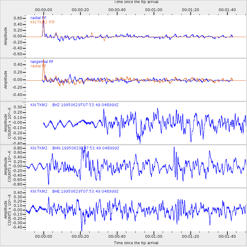
TKM2 KN.TKM2 - Earthquake Result Viewer
*The percent match for this event was below the threshold and hence no stack was calculated.
| Earthquake location: |
Kuril Islands |
| Earthquake latitude/longitude: |
48.8/154.5 |
| Earthquake time(UTC): |
1995/06/29 (180) 07:45:09 GMT |
| Earthquake Depth: |
62 km |
| Earthquake Magnitude: |
5.9 MB, 6.0 UNKNOWN, 6.0 MW |
| Earthquake Catalog/Contributor: |
WHDF/NEIC |
|
| Network: |
KN Kyrgyz Seismic Telemetry Network |
| Station: |
TKM2 KN.TKM2 |
| Lat/Lon: |
42.92 N/75.60 E |
| Elevation: |
2020 m |
|
| Distance: |
52.9 deg |
| Az: |
295.408 deg |
| Baz: |
54.42 deg |
| Ray Param: |
$rayparam |
*The percent match for this event was below the threshold and hence was not used in the summary stack. |
|
| Radial Match: |
78.088684 % |
| Radial Bump: |
400 |
| Transverse Match: |
65.01264 % |
| Transverse Bump: |
400 |
| SOD ConfigId: |
4480 |
| Insert Time: |
2010-03-08 21:15:40.686 +0000 |
| GWidth: |
2.5 |
| Max Bumps: |
400 |
| Tol: |
0.001 |
|
Signal To Noise
| Channel | StoN | STA | LTA |
| KN:TKM2: :BHN:19950629T07:53:49.048999Z | 4.8857956 | 2.7202123E-7 | 5.567593E-8 |
| KN:TKM2: :BHE:19950629T07:53:49.048999Z | 1.8651345 | 1.08218714E-7 | 5.8021936E-8 |
| KN:TKM2: :BHZ:19950629T07:53:49.048999Z | 2.3177693 | 9.696134E-8 | 4.18339E-8 |
| Arrivals |
| Ps | |
| PpPs | |
| PsPs/PpSs | |


