You are here: Home > Network List > AV - Alaska Volcano Observatory Stations List
> Station PLBL Mt. Peulik Volcano, Alaska > Earthquake Result Viewer
PLBL Mt. Peulik Volcano, Alaska - Earthquake Result Viewer
*The percent match for this event was below the threshold and hence no stack was calculated.
| Earthquake location: |
Ryukyu Islands, Japan |
| Earthquake latitude/longitude: |
28.9/128.3 |
| Earthquake time(UTC): |
2020/06/13 (165) 15:51:23 GMT |
| Earthquake Depth: |
160 km |
| Earthquake Magnitude: |
6.6 Mww |
| Earthquake Catalog/Contributor: |
NEIC PDE/us |
|
| Network: |
AV Alaska Volcano Observatory |
| Station: |
PLBL Mt. Peulik Volcano, Alaska |
| Lat/Lon: |
57.70 N/156.82 W |
| Elevation: |
461 m |
|
| Distance: |
58.1 deg |
| Az: |
37.642 deg |
| Baz: |
274.463 deg |
| Ray Param: |
$rayparam |
*The percent match for this event was below the threshold and hence was not used in the summary stack. |
|
| Radial Match: |
73.16408 % |
| Radial Bump: |
400 |
| Transverse Match: |
69.49932 % |
| Transverse Bump: |
400 |
| SOD ConfigId: |
21709731 |
| Insert Time: |
2020-06-27 15:57:58.129 +0000 |
| GWidth: |
2.5 |
| Max Bumps: |
400 |
| Tol: |
0.001 |
|
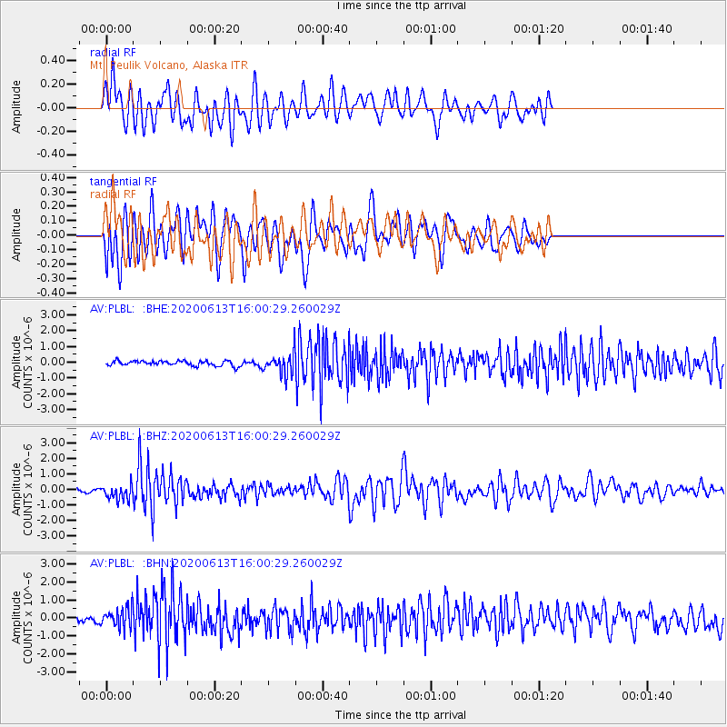
Signal To Noise
| Channel | StoN | STA | LTA |
| AV:PLBL: :BHZ:20200613T16:00:29.260029Z | 3.6993787 | 4.851137E-7 | 1.3113383E-7 |
| AV:PLBL: :BHN:20200613T16:00:29.260029Z | 2.3394349 | 5.3322316E-7 | 2.2792818E-7 |
| AV:PLBL: :BHE:20200613T16:00:29.260029Z | 4.1099887 | 6.6272895E-7 | 1.6124837E-7 |
| Arrivals |
| Ps | |
| PpPs | |
| PsPs/PpSs | |


