You are here: Home > Network List > KN - Kyrgyz Seismic Telemetry Network Stations List
> Station TKM2 KN.TKM2 > Earthquake Result Viewer
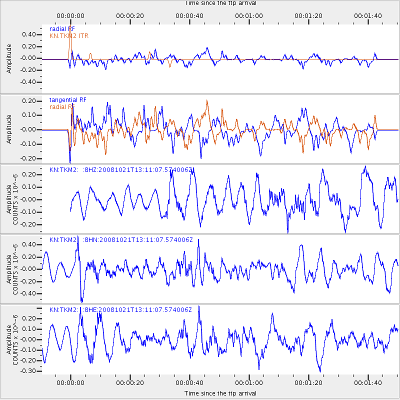
TKM2 KN.TKM2 - Earthquake Result Viewer
*The percent match for this event was below the threshold and hence no stack was calculated.
| Earthquake location: |
Banda Sea |
| Earthquake latitude/longitude: |
-7.5/127.7 |
| Earthquake time(UTC): |
2008/10/21 (295) 13:00:48 GMT |
| Earthquake Depth: |
135 km |
| Earthquake Magnitude: |
5.5 MB, 5.6 MW, 5.5 MW |
| Earthquake Catalog/Contributor: |
WHDF/NEIC |
|
| Network: |
KN Kyrgyz Seismic Telemetry Network |
| Station: |
TKM2 KN.TKM2 |
| Lat/Lon: |
42.92 N/75.60 E |
| Elevation: |
2020 m |
|
| Distance: |
68.9 deg |
| Az: |
321.577 deg |
| Baz: |
122.973 deg |
| Ray Param: |
$rayparam |
*The percent match for this event was below the threshold and hence was not used in the summary stack. |
|
| Radial Match: |
62.041477 % |
| Radial Bump: |
400 |
| Transverse Match: |
42.35277 % |
| Transverse Bump: |
400 |
| SOD ConfigId: |
2556 |
| Insert Time: |
2010-03-08 21:16:03.541 +0000 |
| GWidth: |
2.5 |
| Max Bumps: |
400 |
| Tol: |
0.001 |
|
Signal To Noise
| Channel | StoN | STA | LTA |
| KN:TKM2: :BHN:20081021T13:11:07.574006Z | 2.0815625 | 2.7288303E-7 | 1.3109529E-7 |
| KN:TKM2: :BHE:20081021T13:11:07.574006Z | 1.4600564 | 1.5513726E-7 | 1.06254284E-7 |
| KN:TKM2: :BHZ:20081021T13:11:07.574006Z | 2.0638084 | 1.2664546E-7 | 6.1364936E-8 |
| Arrivals |
| Ps | |
| PpPs | |
| PsPs/PpSs | |


