You are here: Home > Network List > KN - Kyrgyz Seismic Telemetry Network Stations List
> Station TKM2 KN.TKM2 > Earthquake Result Viewer
TKM2 KN.TKM2 - Earthquake Result Viewer
*The percent match for this event was below the threshold and hence no stack was calculated.
| Earthquake location: |
Eastern New Guinea Reg., P.N.G. |
| Earthquake latitude/longitude: |
-5.2/146.3 |
| Earthquake time(UTC): |
1998/01/19 (019) 13:48:07 GMT |
| Earthquake Depth: |
159 km |
| Earthquake Magnitude: |
5.6 UNKNOWN, 5.4 MB |
| Earthquake Catalog/Contributor: |
WHDF/NEIC |
|
| Network: |
KN Kyrgyz Seismic Telemetry Network |
| Station: |
TKM2 KN.TKM2 |
| Lat/Lon: |
42.92 N/75.60 E |
| Elevation: |
2020 m |
|
| Distance: |
79.6 deg |
| Az: |
315.18 deg |
| Baz: |
107.131 deg |
| Ray Param: |
$rayparam |
*The percent match for this event was below the threshold and hence was not used in the summary stack. |
|
| Radial Match: |
43.291233 % |
| Radial Bump: |
400 |
| Transverse Match: |
66.08699 % |
| Transverse Bump: |
400 |
| SOD ConfigId: |
4480 |
| Insert Time: |
2010-03-08 21:16:06.853 +0000 |
| GWidth: |
2.5 |
| Max Bumps: |
400 |
| Tol: |
0.001 |
|
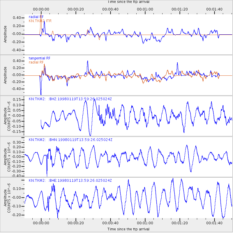
Signal To Noise
| Channel | StoN | STA | LTA |
| KN:TKM2: :BHN:19980119T13:59:26.025024Z | 2.1296191 | 1.1470703E-7 | 5.3862696E-8 |
| KN:TKM2: :BHE:19980119T13:59:26.025024Z | 2.2390313 | 1.2644391E-7 | 5.6472597E-8 |
| KN:TKM2: :BHZ:19980119T13:59:26.025024Z | 1.7935439 | 1.0028688E-7 | 5.5915486E-8 |
| Arrivals |
| Ps | |
| PpPs | |
| PsPs/PpSs | |


