You are here: Home > Network List > KN - Kyrgyz Seismic Telemetry Network Stations List
> Station TKM2 KN.TKM2 > Earthquake Result Viewer
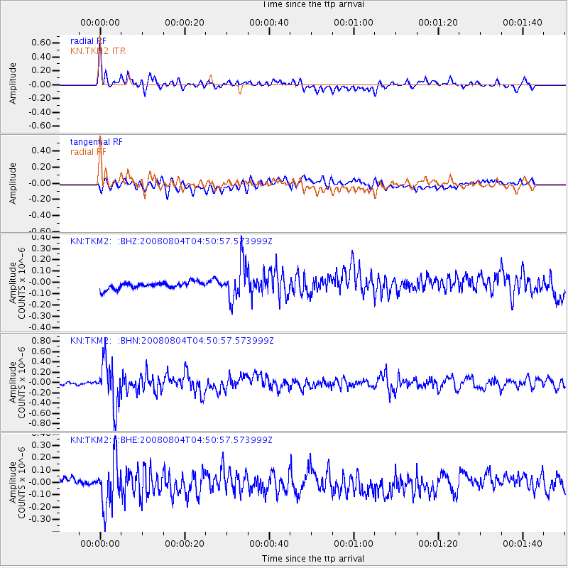
TKM2 KN.TKM2 - Earthquake Result Viewer
*The percent match for this event was below the threshold and hence no stack was calculated.
| Earthquake location: |
Kuril Islands |
| Earthquake latitude/longitude: |
49.9/156.4 |
| Earthquake time(UTC): |
2008/08/04 (217) 04:42:14 GMT |
| Earthquake Depth: |
77 km |
| Earthquake Magnitude: |
5.6 MB, 5.8 MW, 5.7 MW |
| Earthquake Catalog/Contributor: |
WHDF/NEIC |
|
| Network: |
KN Kyrgyz Seismic Telemetry Network |
| Station: |
TKM2 KN.TKM2 |
| Lat/Lon: |
42.92 N/75.60 E |
| Elevation: |
2020 m |
|
| Distance: |
53.6 deg |
| Az: |
295.736 deg |
| Baz: |
52.539 deg |
| Ray Param: |
$rayparam |
*The percent match for this event was below the threshold and hence was not used in the summary stack. |
|
| Radial Match: |
71.71973 % |
| Radial Bump: |
400 |
| Transverse Match: |
63.565228 % |
| Transverse Bump: |
400 |
| SOD ConfigId: |
2504 |
| Insert Time: |
2010-03-08 21:16:30.807 +0000 |
| GWidth: |
2.5 |
| Max Bumps: |
400 |
| Tol: |
0.001 |
|
Signal To Noise
| Channel | StoN | STA | LTA |
| KN:TKM2: :BHN:20080804T04:50:57.573999Z | 10.505557 | 4.424887E-7 | 4.2119485E-8 |
| KN:TKM2: :BHE:20080804T04:50:57.573999Z | 3.9555645 | 1.9010153E-7 | 4.8059267E-8 |
| KN:TKM2: :BHZ:20080804T04:50:57.573999Z | 5.85276 | 1.6965772E-7 | 2.8987644E-8 |
| Arrivals |
| Ps | |
| PpPs | |
| PsPs/PpSs | |


