You are here: Home > Network List > KN - Kyrgyz Seismic Telemetry Network Stations List
> Station TKM2 KN.TKM2 > Earthquake Result Viewer
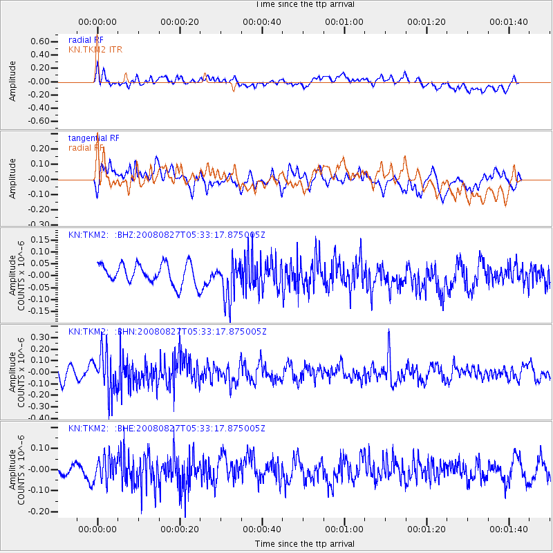
TKM2 KN.TKM2 - Earthquake Result Viewer
*The percent match for this event was below the threshold and hence no stack was calculated.
| Earthquake location: |
Kuril Islands |
| Earthquake latitude/longitude: |
46.7/152.5 |
| Earthquake time(UTC): |
2008/08/27 (240) 05:24:41 GMT |
| Earthquake Depth: |
65 km |
| Earthquake Magnitude: |
5.5 MB, 5.4 MW, 5.3 MW |
| Earthquake Catalog/Contributor: |
WHDF/NEIC |
|
| Network: |
KN Kyrgyz Seismic Telemetry Network |
| Station: |
TKM2 KN.TKM2 |
| Lat/Lon: |
42.92 N/75.60 E |
| Elevation: |
2020 m |
|
| Distance: |
52.6 deg |
| Az: |
295.799 deg |
| Baz: |
57.476 deg |
| Ray Param: |
$rayparam |
*The percent match for this event was below the threshold and hence was not used in the summary stack. |
|
| Radial Match: |
49.771603 % |
| Radial Bump: |
400 |
| Transverse Match: |
47.042046 % |
| Transverse Bump: |
400 |
| SOD ConfigId: |
2504 |
| Insert Time: |
2010-03-08 21:16:31.513 +0000 |
| GWidth: |
2.5 |
| Max Bumps: |
400 |
| Tol: |
0.001 |
|
Signal To Noise
| Channel | StoN | STA | LTA |
| KN:TKM2: :BHN:20080827T05:33:17.875005Z | 3.8672876 | 1.7995222E-7 | 4.653189E-8 |
| KN:TKM2: :BHE:20080827T05:33:17.875005Z | 1.1501756 | 5.4075613E-8 | 4.7015096E-8 |
| KN:TKM2: :BHZ:20080827T05:33:17.875005Z | 1.9043152 | 8.105327E-8 | 4.256295E-8 |
| Arrivals |
| Ps | |
| PpPs | |
| PsPs/PpSs | |


