You are here: Home > Network List > KN - Kyrgyz Seismic Telemetry Network Stations List
> Station TKM2 KN.TKM2 > Earthquake Result Viewer
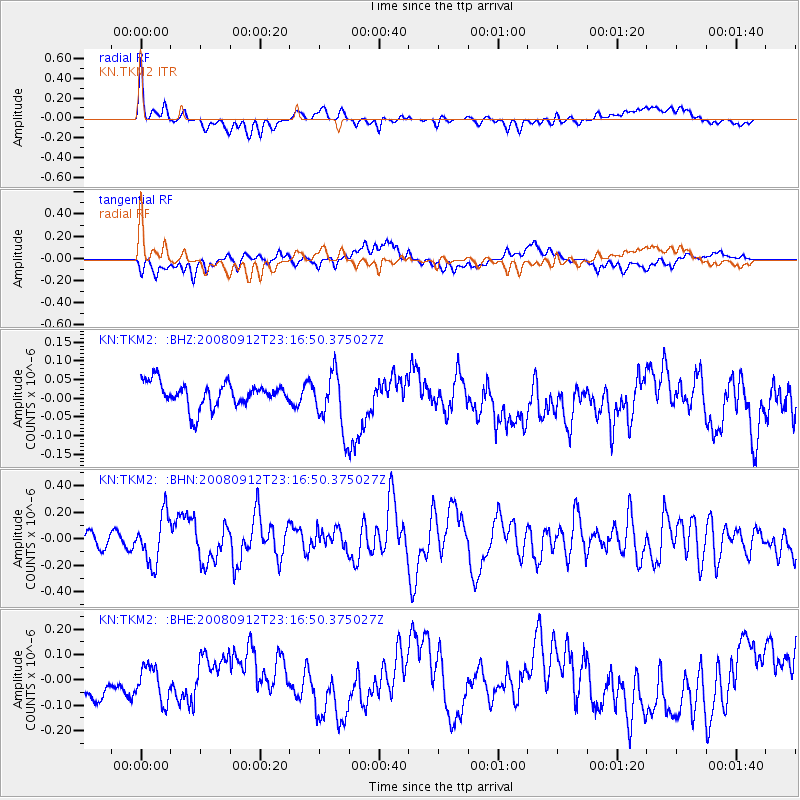
TKM2 KN.TKM2 - Earthquake Result Viewer
*The percent match for this event was below the threshold and hence no stack was calculated.
| Earthquake location: |
Komandorskiye Ostrova Region |
| Earthquake latitude/longitude: |
56.3/164.1 |
| Earthquake time(UTC): |
2008/09/12 (256) 23:07:50 GMT |
| Earthquake Depth: |
9.3 km |
| Earthquake Magnitude: |
5.5 MB, 5.7 MS, 5.9 MW, 5.9 MW |
| Earthquake Catalog/Contributor: |
WHDF/NEIC |
|
| Network: |
KN Kyrgyz Seismic Telemetry Network |
| Station: |
TKM2 KN.TKM2 |
| Lat/Lon: |
42.92 N/75.60 E |
| Elevation: |
2020 m |
|
| Distance: |
55.0 deg |
| Az: |
296.25 deg |
| Baz: |
42.881 deg |
| Ray Param: |
$rayparam |
*The percent match for this event was below the threshold and hence was not used in the summary stack. |
|
| Radial Match: |
61.444103 % |
| Radial Bump: |
400 |
| Transverse Match: |
56.55942 % |
| Transverse Bump: |
400 |
| SOD ConfigId: |
2560 |
| Insert Time: |
2010-03-08 21:16:34.503 +0000 |
| GWidth: |
2.5 |
| Max Bumps: |
400 |
| Tol: |
0.001 |
|
Signal To Noise
| Channel | StoN | STA | LTA |
| KN:TKM2: :BHN:20080912T23:16:50.375027Z | 3.6338868 | 1.8022145E-7 | 4.959468E-8 |
| KN:TKM2: :BHE:20080912T23:16:50.375027Z | 1.1578443 | 6.8398755E-8 | 5.9074225E-8 |
| KN:TKM2: :BHZ:20080912T23:16:50.375027Z | 2.3398445 | 7.671193E-8 | 3.2785056E-8 |
| Arrivals |
| Ps | |
| PpPs | |
| PsPs/PpSs | |


