You are here: Home > Network List > KN - Kyrgyz Seismic Telemetry Network Stations List
> Station TKM2 KN.TKM2 > Earthquake Result Viewer
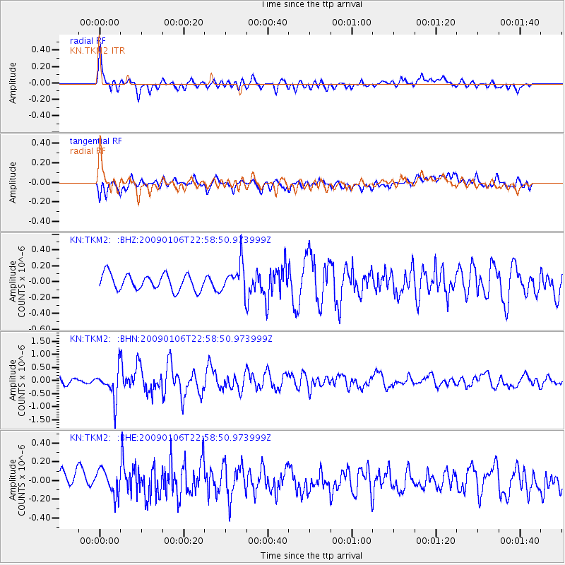
TKM2 KN.TKM2 - Earthquake Result Viewer
*The percent match for this event was below the threshold and hence no stack was calculated.
| Earthquake location: |
Irian Jaya Region, Indonesia |
| Earthquake latitude/longitude: |
-0.7/133.4 |
| Earthquake time(UTC): |
2009/01/06 (006) 22:48:27 GMT |
| Earthquake Depth: |
16 km |
| Earthquake Magnitude: |
5.9 MB, 5.9 MS, 6.0 MW, 6.0 MW |
| Earthquake Catalog/Contributor: |
WHDF/NEIC |
|
| Network: |
KN Kyrgyz Seismic Telemetry Network |
| Station: |
TKM2 KN.TKM2 |
| Lat/Lon: |
42.92 N/75.60 E |
| Elevation: |
2020 m |
|
| Distance: |
67.5 deg |
| Az: |
317.681 deg |
| Baz: |
113.586 deg |
| Ray Param: |
$rayparam |
*The percent match for this event was below the threshold and hence was not used in the summary stack. |
|
| Radial Match: |
78.85443 % |
| Radial Bump: |
400 |
| Transverse Match: |
54.647488 % |
| Transverse Bump: |
400 |
| SOD ConfigId: |
2834 |
| Insert Time: |
2010-03-08 21:16:36.158 +0000 |
| GWidth: |
2.5 |
| Max Bumps: |
400 |
| Tol: |
0.001 |
|
Signal To Noise
| Channel | StoN | STA | LTA |
| KN:TKM2: :BHN:20090106T22:58:50.973999Z | 6.5427938 | 5.818898E-7 | 8.8935984E-8 |
| KN:TKM2: :BHE:20090106T22:58:50.973999Z | 0.9970011 | 1.4793817E-7 | 1.4838314E-7 |
| KN:TKM2: :BHZ:20090106T22:58:50.973999Z | 1.9123688 | 1.8866528E-7 | 9.865528E-8 |
| Arrivals |
| Ps | |
| PpPs | |
| PsPs/PpSs | |


