You are here: Home > Network List > KN - Kyrgyz Seismic Telemetry Network Stations List
> Station TKM2 KN.TKM2 > Earthquake Result Viewer
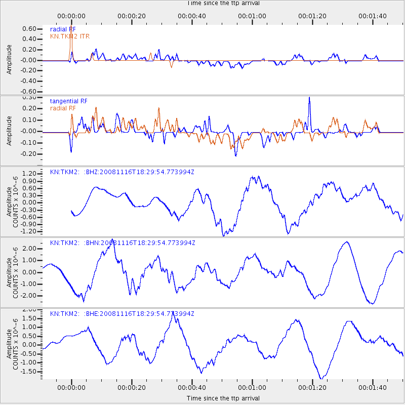
TKM2 KN.TKM2 - Earthquake Result Viewer
*The percent match for this event was below the threshold and hence no stack was calculated.
| Earthquake location: |
Minahassa Peninsula, Sulawesi |
| Earthquake latitude/longitude: |
1.1/121.8 |
| Earthquake time(UTC): |
2008/11/16 (321) 18:20:32 GMT |
| Earthquake Depth: |
35 km |
| Earthquake Magnitude: |
5.5 MB |
| Earthquake Catalog/Contributor: |
WHDF/NEIC |
|
| Network: |
KN Kyrgyz Seismic Telemetry Network |
| Station: |
TKM2 KN.TKM2 |
| Lat/Lon: |
42.92 N/75.60 E |
| Elevation: |
2020 m |
|
| Distance: |
58.5 deg |
| Az: |
321.591 deg |
| Baz: |
122.264 deg |
| Ray Param: |
$rayparam |
*The percent match for this event was below the threshold and hence was not used in the summary stack. |
|
| Radial Match: |
53.859722 % |
| Radial Bump: |
400 |
| Transverse Match: |
46.276566 % |
| Transverse Bump: |
400 |
| SOD ConfigId: |
2658 |
| Insert Time: |
2010-03-08 21:16:37.918 +0000 |
| GWidth: |
2.5 |
| Max Bumps: |
400 |
| Tol: |
0.001 |
|
Signal To Noise
| Channel | StoN | STA | LTA |
| KN:TKM2: :BHN:20081116T18:29:54.773994Z | 4.3236394 | 1.7927996E-6 | 4.146506E-7 |
| KN:TKM2: :BHE:20081116T18:29:54.773994Z | 2.3801277 | 1.0199713E-6 | 4.2853637E-7 |
| KN:TKM2: :BHZ:20081116T18:29:54.773994Z | 1.131358 | 4.0448995E-7 | 3.5752603E-7 |
| Arrivals |
| Ps | |
| PpPs | |
| PsPs/PpSs | |


