You are here: Home > Network List > KN - Kyrgyz Seismic Telemetry Network Stations List
> Station TKM2 KN.TKM2 > Earthquake Result Viewer
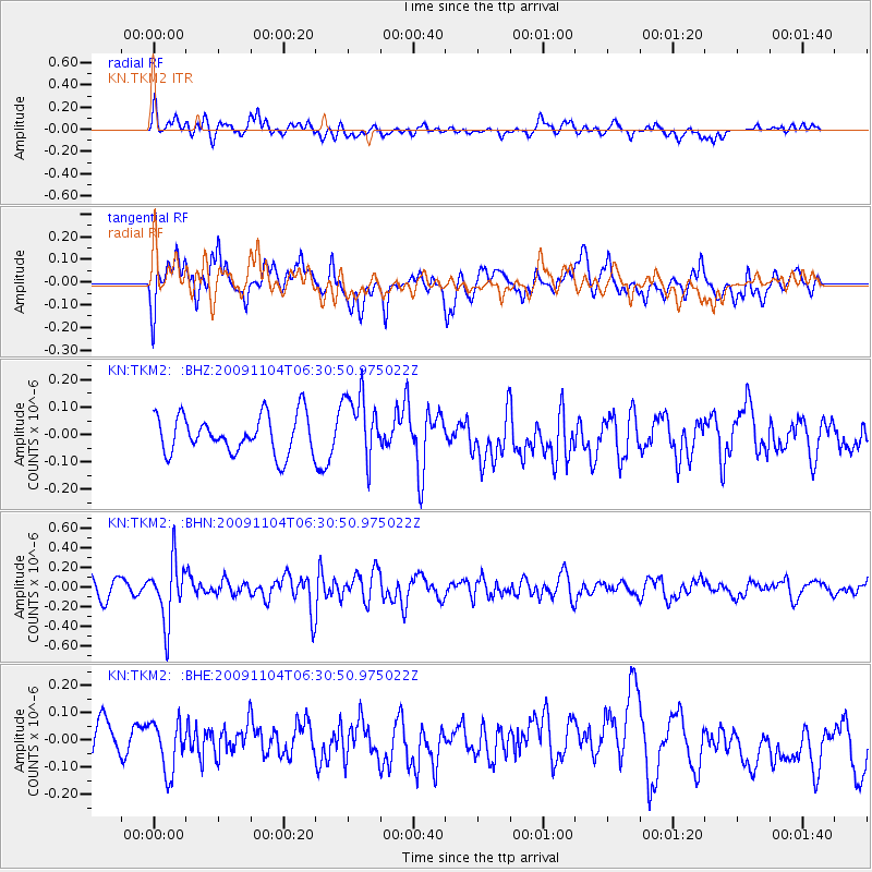
TKM2 KN.TKM2 - Earthquake Result Viewer
*The percent match for this event was below the threshold and hence no stack was calculated.
| Earthquake location: |
Mindanao, Philippines |
| Earthquake latitude/longitude: |
7.1/126.6 |
| Earthquake time(UTC): |
2009/11/04 (308) 06:21:46 GMT |
| Earthquake Depth: |
116 km |
| Earthquake Magnitude: |
5.5 MB, 5.5 MW |
| Earthquake Catalog/Contributor: |
WHDF/NEIC |
|
| Network: |
KN Kyrgyz Seismic Telemetry Network |
| Station: |
TKM2 KN.TKM2 |
| Lat/Lon: |
42.92 N/75.60 E |
| Elevation: |
2020 m |
|
| Distance: |
57.2 deg |
| Az: |
317.219 deg |
| Baz: |
113.417 deg |
| Ray Param: |
$rayparam |
*The percent match for this event was below the threshold and hence was not used in the summary stack. |
|
| Radial Match: |
49.472637 % |
| Radial Bump: |
400 |
| Transverse Match: |
63.88787 % |
| Transverse Bump: |
400 |
| SOD ConfigId: |
2622 |
| Insert Time: |
2010-03-08 21:16:55.021 +0000 |
| GWidth: |
2.5 |
| Max Bumps: |
400 |
| Tol: |
0.001 |
|
Signal To Noise
| Channel | StoN | STA | LTA |
| KN:TKM2: :BHN:20091104T06:30:50.975022Z | 3.1374922 | 3.0770266E-7 | 9.807281E-8 |
| KN:TKM2: :BHE:20091104T06:30:50.975022Z | 1.6245022 | 9.0817515E-8 | 5.5904824E-8 |
| KN:TKM2: :BHZ:20091104T06:30:50.975022Z | 1.7601564 | 1.2245812E-7 | 6.9572295E-8 |
| Arrivals |
| Ps | |
| PpPs | |
| PsPs/PpSs | |


