UCH KN.UCH - Earthquake Result Viewer
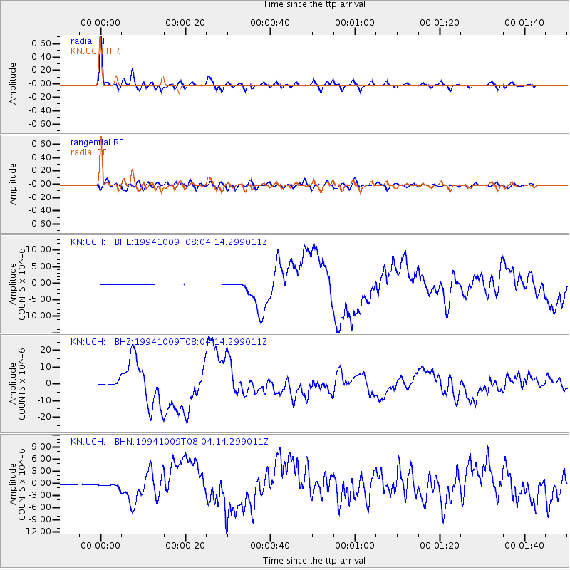
Earthquake location: Kuril Islands
Earthquake latitude/longitude: 43.9/147.9
Earthquake time(UTC): 1994/10/09 (282) 07:55:38 GMT
Earthquake Depth: 23 km
Earthquake Magnitude: 6.5 MB, 7.0 MS, 6.7 UNKNOWN, 7.3 MW
Earthquake Catalog/Contributor: WHDF/NEIC
Network: KN Kyrgyz Seismic Telemetry Network
Station: UCH KN.UCH
Lat/Lon: 42.23 N/74.51 E
Elevation: 3850 m
Distance: 52.0 deg
Az: 295.36 deg
Baz: 61.582 deg
Ray Param: 0.0670316
Estimated Moho Depth: 48.5 km
Estimated Crust Vp/Vs: 1.92
Assumed Crust Vp: 6.306 km/s
Estimated Crust Vs: 3.284 km/s
Estimated Crust Poisson's Ratio: 0.31
Radial Match: 96.467476 %
Radial Bump: 363
Transverse Match: 80.878265 %
Transverse Bump: 400
SOD ConfigId: 4480
Insert Time: 2010-03-08 21:17:12.119 +0000
GWidth: 2.5
Max Bumps: 400
Tol: 0.001

Signal To Noise

ChannelStoNSTALTA
KN:UCH: :BHZ:19941009T08:04:14.299011Z24.4793971.8244413E-67.4529666E-8
KN:UCH: :BHN:19941009T08:04:14.299011Z9.5482416.029946E-76.315243E-8
KN:UCH: :BHE:19941009T08:04:14.299011Z6.02784876.635467E-71.1008018E-7
Arrivals
Ps7.4 SECOND
PpPs21 SECOND
PsPs/PpSs29 SECOND