You are here: Home > Network List > AV - Alaska Volcano Observatory Stations List
> Station AMKA Regional Station, Amchitka Island, Alaska > Earthquake Result Viewer
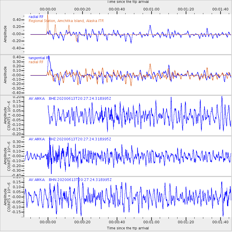
AMKA Regional Station, Amchitka Island, Alaska - Earthquake Result Viewer
*The percent match for this event was below the threshold and hence no stack was calculated.
| Earthquake location: |
Taiwan Region |
| Earthquake latitude/longitude: |
24.3/122.5 |
| Earthquake time(UTC): |
2020/06/13 (165) 20:18:59 GMT |
| Earthquake Depth: |
54 km |
| Earthquake Magnitude: |
5.4 Mww |
| Earthquake Catalog/Contributor: |
NEIC PDE/us |
|
| Network: |
AV Alaska Volcano Observatory |
| Station: |
AMKA Regional Station, Amchitka Island, Alaska |
| Lat/Lon: |
51.38 N/179.30 E |
| Elevation: |
116 m |
|
| Distance: |
50.8 deg |
| Az: |
42.595 deg |
| Baz: |
260.163 deg |
| Ray Param: |
$rayparam |
*The percent match for this event was below the threshold and hence was not used in the summary stack. |
|
| Radial Match: |
55.36692 % |
| Radial Bump: |
400 |
| Transverse Match: |
44.32765 % |
| Transverse Bump: |
400 |
| SOD ConfigId: |
21709731 |
| Insert Time: |
2020-06-27 20:24:01.014 +0000 |
| GWidth: |
2.5 |
| Max Bumps: |
400 |
| Tol: |
0.001 |
|
Signal To Noise
| Channel | StoN | STA | LTA |
| AV:AMKA: :BHZ:20200613T20:27:24.318995Z | 2.410747 | 1.3681168E-7 | 5.6750743E-8 |
| AV:AMKA: :BHN:20200613T20:27:24.318995Z | 1.4320924 | 7.835145E-8 | 5.4711162E-8 |
| AV:AMKA: :BHE:20200613T20:27:24.318995Z | 1.0548325 | 5.5703836E-8 | 5.2808232E-8 |
| Arrivals |
| Ps | |
| PpPs | |
| PsPs/PpSs | |


