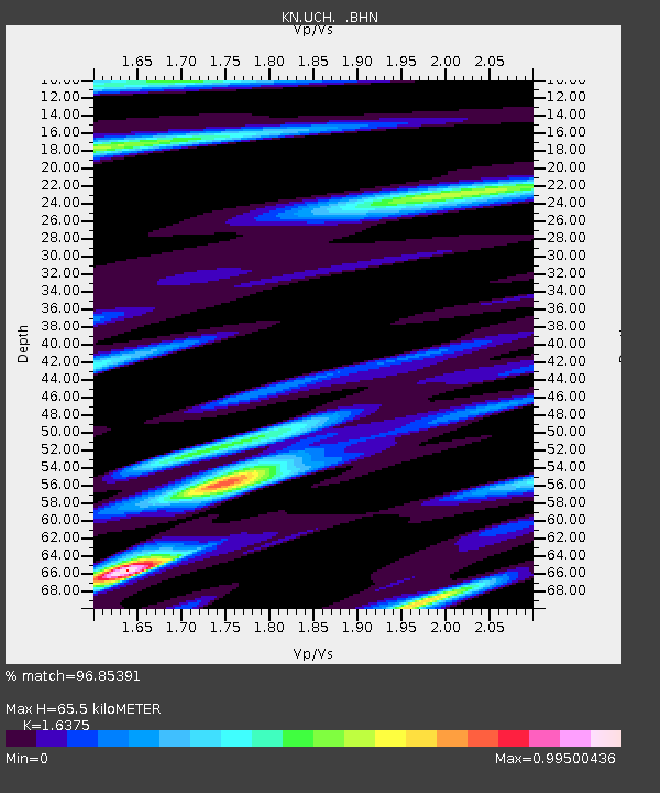
UCH KN.UCH - Earthquake Result Viewer
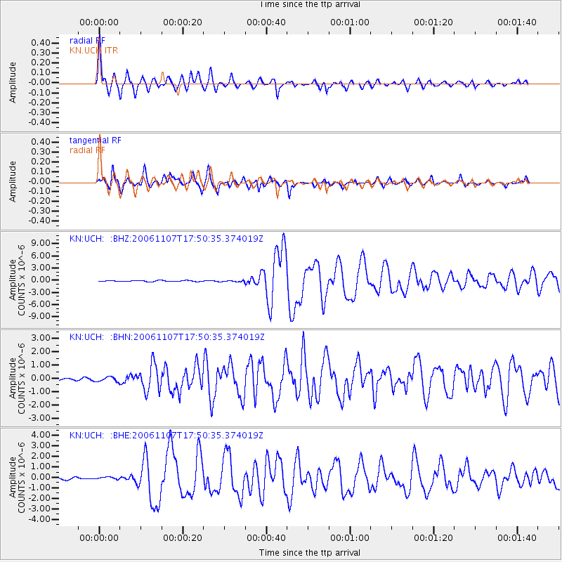
Earthquake location: New Britain Region, P.N.G.
Earthquake latitude/longitude: -6.5/151.2
Earthquake time(UTC): 2006/11/07 (311) 17:38:33 GMT
Earthquake Depth: 10 km
Earthquake Magnitude: 6.2 MB, 6.3 MS, 6.5 MW, 6.4 MW
Earthquake Catalog/Contributor: WHDF/NEIC
Network: KN Kyrgyz Seismic Telemetry Network
Station: UCH KN.UCH
Lat/Lon: 42.23 N/74.51 E
Elevation: 3850 m
Distance: 84.6 deg
Az: 313.446 deg
Baz: 103.747 deg
Ray Param: 0.045400467
Estimated Moho Depth: 65.5 km
Estimated Crust Vp/Vs: 1.64
Assumed Crust Vp: 6.306 km/s
Estimated Crust Vs: 3.851 km/s
Estimated Crust Poisson's Ratio: 0.20
Radial Match: 96.85391 %
Radial Bump: 400
Transverse Match: 92.40224 %
Transverse Bump: 400
SOD ConfigId: 2564
Insert Time: 2010-03-08 21:19:11.333 +0000
GWidth: 2.5
Max Bumps: 400
Tol: 0.001

Signal To Noise

ChannelStoNSTALTA
KN:UCH: :BHN:20061107T17:50:35.374019Z1.17701281.9747081E-71.6777287E-7
KN:UCH: :BHE:20061107T17:50:35.374019Z0.50611549.716341E-81.9197877E-7
KN:UCH: :BHZ:20061107T17:50:35.374019Z1.03485511.3654032E-71.3194148E-7
Arrivals
Ps6.8 SECOND
PpPs27 SECOND
PsPs/PpSs33 SECOND