
UCH KN.UCH - Earthquake Result Viewer
| ||||||||||||||||||
| ||||||||||||||||||
| ||||||||||||||||||
|
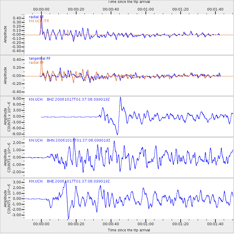
Signal To Noise
| Channel | StoN | STA | LTA |
| KN:UCH: :BHN:20061017T01:37:08.099019Z | 0.9990729 | 5.9601064E-8 | 5.965637E-8 |
| KN:UCH: :BHE:20061017T01:37:08.099019Z | 1.8387003 | 1.6694565E-7 | 9.079547E-8 |
| KN:UCH: :BHZ:20061017T01:37:08.099019Z | 11.243031 | 6.4174714E-7 | 5.7079554E-8 |
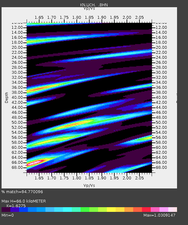
| Arrivals | |
| Ps | 6.7 SECOND |
| PpPs | 27 SECOND |
| PsPs/PpSs | 34 SECOND |

