You are here: Home > Network List > TA - USArray Transportable Network (new EarthScope stations) Stations List
> Station E18K Tukpahlearik Creek, AK, USA > Earthquake Result Viewer
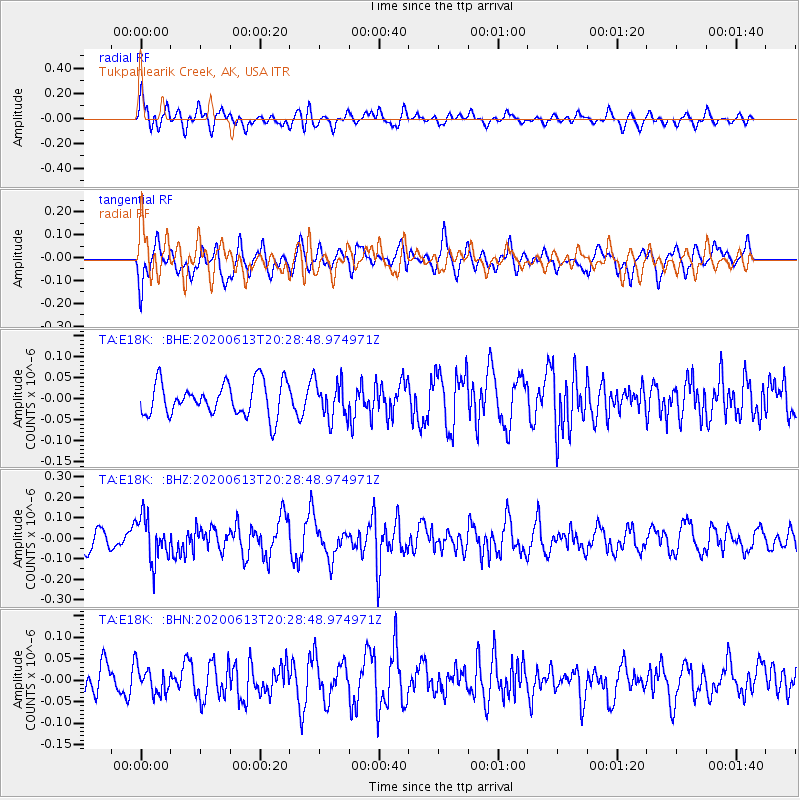
E18K Tukpahlearik Creek, AK, USA - Earthquake Result Viewer
*The percent match for this event was below the threshold and hence no stack was calculated.
| Earthquake location: |
Taiwan Region |
| Earthquake latitude/longitude: |
24.3/122.5 |
| Earthquake time(UTC): |
2020/06/13 (165) 20:18:59 GMT |
| Earthquake Depth: |
54 km |
| Earthquake Magnitude: |
5.4 Mww |
| Earthquake Catalog/Contributor: |
NEIC PDE/us |
|
| Network: |
TA USArray Transportable Network (new EarthScope stations) |
| Station: |
E18K Tukpahlearik Creek, AK, USA |
| Lat/Lon: |
67.42 N/160.60 W |
| Elevation: |
297 m |
|
| Distance: |
62.8 deg |
| Az: |
25.021 deg |
| Baz: |
267.918 deg |
| Ray Param: |
$rayparam |
*The percent match for this event was below the threshold and hence was not used in the summary stack. |
|
| Radial Match: |
63.185543 % |
| Radial Bump: |
400 |
| Transverse Match: |
58.92567 % |
| Transverse Bump: |
400 |
| SOD ConfigId: |
21709731 |
| Insert Time: |
2020-06-27 20:34:04.891 +0000 |
| GWidth: |
2.5 |
| Max Bumps: |
400 |
| Tol: |
0.001 |
|
Signal To Noise
| Channel | StoN | STA | LTA |
| TA:E18K: :BHZ:20200613T20:28:48.974971Z | 2.5221531 | 1.0775551E-7 | 4.272362E-8 |
| TA:E18K: :BHN:20200613T20:28:48.974971Z | 1.0811578 | 3.063283E-8 | 2.8333359E-8 |
| TA:E18K: :BHE:20200613T20:28:48.974971Z | 1.1083281 | 4.39272E-8 | 3.963375E-8 |
| Arrivals |
| Ps | |
| PpPs | |
| PsPs/PpSs | |


