You are here: Home > Network List > TA - USArray Transportable Network (new EarthScope stations) Stations List
> Station I17K Unalakleet, AK, USA > Earthquake Result Viewer
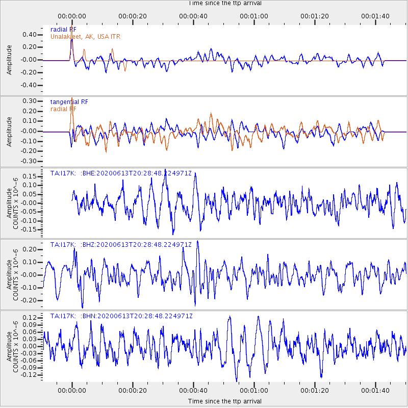
I17K Unalakleet, AK, USA - Earthquake Result Viewer
*The percent match for this event was below the threshold and hence no stack was calculated.
| Earthquake location: |
Taiwan Region |
| Earthquake latitude/longitude: |
24.3/122.5 |
| Earthquake time(UTC): |
2020/06/13 (165) 20:18:59 GMT |
| Earthquake Depth: |
54 km |
| Earthquake Magnitude: |
5.4 Mww |
| Earthquake Catalog/Contributor: |
NEIC PDE/us |
|
| Network: |
TA USArray Transportable Network (new EarthScope stations) |
| Station: |
I17K Unalakleet, AK, USA |
| Lat/Lon: |
63.89 N/160.70 W |
| Elevation: |
105 m |
|
| Distance: |
62.7 deg |
| Az: |
29.014 deg |
| Baz: |
269.664 deg |
| Ray Param: |
$rayparam |
*The percent match for this event was below the threshold and hence was not used in the summary stack. |
|
| Radial Match: |
56.411793 % |
| Radial Bump: |
400 |
| Transverse Match: |
49.097237 % |
| Transverse Bump: |
400 |
| SOD ConfigId: |
21709731 |
| Insert Time: |
2020-06-27 20:34:58.309 +0000 |
| GWidth: |
2.5 |
| Max Bumps: |
400 |
| Tol: |
0.001 |
|
Signal To Noise
| Channel | StoN | STA | LTA |
| TA:I17K: :BHZ:20200613T20:28:48.224971Z | 1.6649876 | 1.1528954E-7 | 6.9243484E-8 |
| TA:I17K: :BHN:20200613T20:28:48.224971Z | 1.0575396 | 5.240851E-8 | 4.955702E-8 |
| TA:I17K: :BHE:20200613T20:28:48.224971Z | 2.013707 | 9.595749E-8 | 4.7652158E-8 |
| Arrivals |
| Ps | |
| PpPs | |
| PsPs/PpSs | |


