You are here: Home > Network List > US - United States National Seismic Network Stations List
> Station EGMT Eagleton, Montana, USA > Earthquake Result Viewer
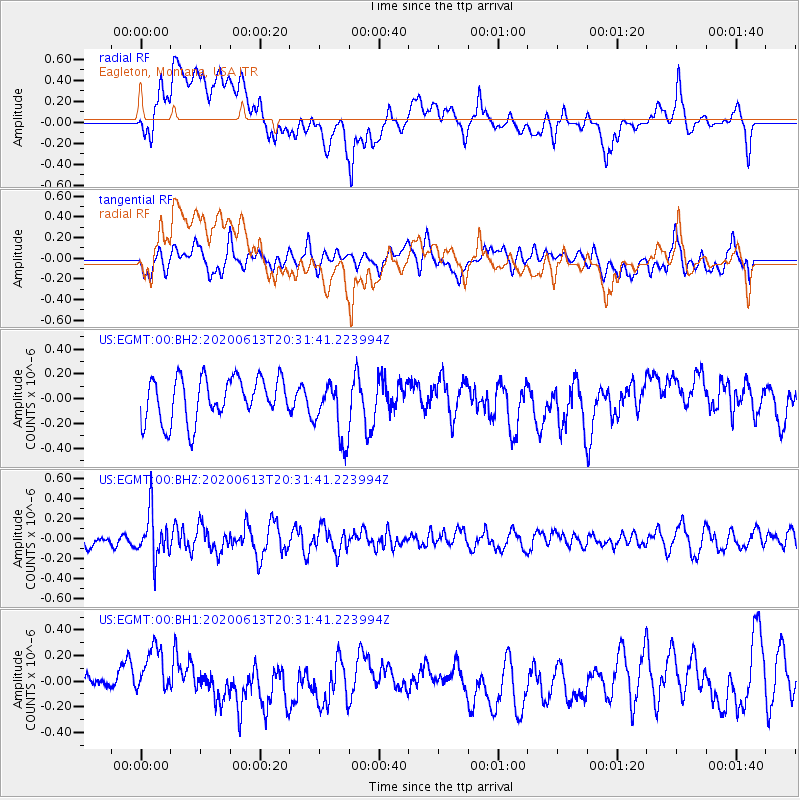
EGMT Eagleton, Montana, USA - Earthquake Result Viewer
*The percent match for this event was below the threshold and hence no stack was calculated.
| Earthquake location: |
Taiwan Region |
| Earthquake latitude/longitude: |
24.3/122.5 |
| Earthquake time(UTC): |
2020/06/13 (165) 20:18:59 GMT |
| Earthquake Depth: |
54 km |
| Earthquake Magnitude: |
5.4 Mww |
| Earthquake Catalog/Contributor: |
NEIC PDE/us |
|
| Network: |
US United States National Seismic Network |
| Station: |
EGMT Eagleton, Montana, USA |
| Lat/Lon: |
48.02 N/109.75 W |
| Elevation: |
1055 m |
|
| Distance: |
94.1 deg |
| Az: |
32.14 deg |
| Baz: |
313.694 deg |
| Ray Param: |
$rayparam |
*The percent match for this event was below the threshold and hence was not used in the summary stack. |
|
| Radial Match: |
42.12572 % |
| Radial Bump: |
400 |
| Transverse Match: |
42.620712 % |
| Transverse Bump: |
400 |
| SOD ConfigId: |
21709731 |
| Insert Time: |
2020-06-27 20:36:45.816 +0000 |
| GWidth: |
2.5 |
| Max Bumps: |
400 |
| Tol: |
0.001 |
|
Signal To Noise
| Channel | StoN | STA | LTA |
| US:EGMT:00:BHZ:20200613T20:31:41.223994Z | 3.3457508 | 2.2696719E-7 | 6.783745E-8 |
| US:EGMT:00:BH1:20200613T20:31:41.223994Z | 1.0722783 | 2.0374917E-7 | 1.900152E-7 |
| US:EGMT:00:BH2:20200613T20:31:41.223994Z | 1.4061233 | 2.441523E-7 | 1.7363506E-7 |
| Arrivals |
| Ps | |
| PpPs | |
| PsPs/PpSs | |


