You are here: Home > Network List > UW - Pacific Northwest Regional Seismic Network Stations List
> Station LEBA Lebam, WA, USA > Earthquake Result Viewer
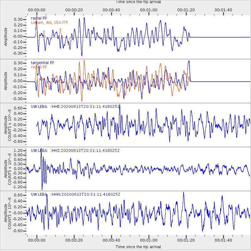
LEBA Lebam, WA, USA - Earthquake Result Viewer
*The percent match for this event was below the threshold and hence no stack was calculated.
| Earthquake location: |
Taiwan Region |
| Earthquake latitude/longitude: |
24.3/122.5 |
| Earthquake time(UTC): |
2020/06/13 (165) 20:18:59 GMT |
| Earthquake Depth: |
54 km |
| Earthquake Magnitude: |
5.4 Mww |
| Earthquake Catalog/Contributor: |
NEIC PDE/us |
|
| Network: |
UW Pacific Northwest Regional Seismic Network |
| Station: |
LEBA Lebam, WA, USA |
| Lat/Lon: |
46.55 N/123.56 W |
| Elevation: |
73 m |
|
| Distance: |
87.7 deg |
| Az: |
39.14 deg |
| Baz: |
303.446 deg |
| Ray Param: |
$rayparam |
*The percent match for this event was below the threshold and hence was not used in the summary stack. |
|
| Radial Match: |
53.466747 % |
| Radial Bump: |
400 |
| Transverse Match: |
52.03539 % |
| Transverse Bump: |
400 |
| SOD ConfigId: |
21709731 |
| Insert Time: |
2020-06-27 20:37:35.144 +0000 |
| GWidth: |
2.5 |
| Max Bumps: |
400 |
| Tol: |
0.001 |
|
Signal To Noise
| Channel | StoN | STA | LTA |
| UW:LEBA: :HHZ:20200613T20:31:11.418025Z | 3.6365006 | 5.2969517E-7 | 1.4566068E-7 |
| UW:LEBA: :HHN:20200613T20:31:11.418025Z | 1.1192029 | 1.8106124E-7 | 1.6177697E-7 |
| UW:LEBA: :HHE:20200613T20:31:11.418025Z | 1.0472046 | 1.973312E-7 | 1.8843615E-7 |
| Arrivals |
| Ps | |
| PpPs | |
| PsPs/PpSs | |


