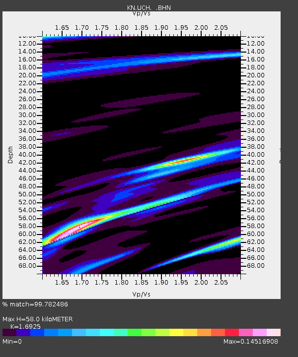
UCH KN.UCH - Earthquake Result Viewer
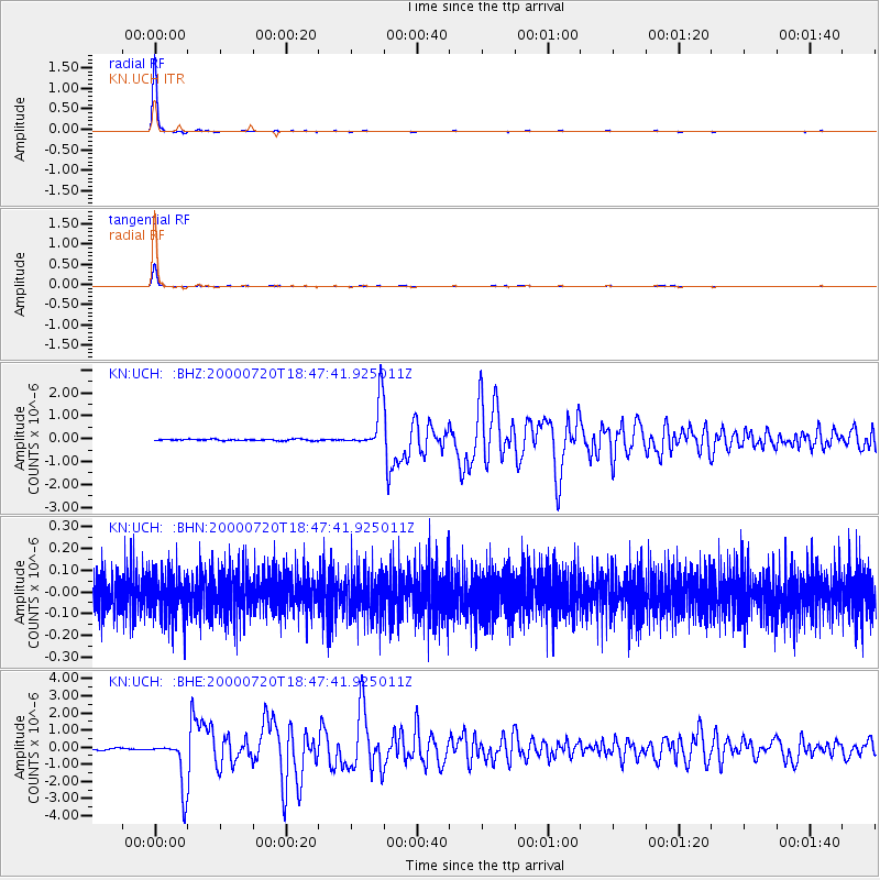
Earthquake location: Near East Coast Of Honshu, Japan
Earthquake latitude/longitude: 36.5/141.0
Earthquake time(UTC): 2000/07/20 (202) 18:39:18 GMT
Earthquake Depth: 47 km
Earthquake Magnitude: 6.1 MB, 5.4 MS, 6.1 ME, 6.0 MW
Earthquake Catalog/Contributor: WHDF/NEIC
Network: KN Kyrgyz Seismic Telemetry Network
Station: UCH KN.UCH
Lat/Lon: 42.23 N/74.51 E
Elevation: 3850 m
Distance: 50.5 deg
Az: 298.114 deg
Baz: 73.087 deg
Ray Param: 0.06786883
Estimated Moho Depth: 58.0 km
Estimated Crust Vp/Vs: 1.69
Assumed Crust Vp: 6.306 km/s
Estimated Crust Vs: 3.726 km/s
Estimated Crust Poisson's Ratio: 0.23
Radial Match: 99.782486 %
Radial Bump: 55
Transverse Match: 99.58213 %
Transverse Bump: 72
SOD ConfigId: 3744
Insert Time: 2010-03-08 21:20:08.510 +0000
GWidth: 2.5
Max Bumps: 400
Tol: 0.001

Signal To Noise

ChannelStoNSTALTA
KN:UCH: :BHN:20000720T18:47:41.925011Z1.04777139.312316E-88.887737E-8
KN:UCH: :BHE:20000720T18:47:41.925011Z35.0749631.4090166E-64.0171578E-8
KN:UCH: :BHZ:20000720T18:47:41.925011Z34.291281.0287459E-63.0000223E-8
Arrivals
Ps6.7 SECOND
PpPs23 SECOND
PsPs/PpSs30 SECOND