You are here: Home > Network List > AV - Alaska Volcano Observatory Stations List
> Station PLBL Mt. Peulik Volcano, Alaska > Earthquake Result Viewer
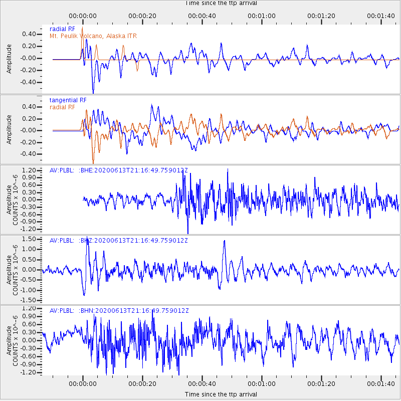
PLBL Mt. Peulik Volcano, Alaska - Earthquake Result Viewer
*The percent match for this event was below the threshold and hence no stack was calculated.
| Earthquake location: |
Mariana Islands |
| Earthquake latitude/longitude: |
18.9/145.1 |
| Earthquake time(UTC): |
2020/06/13 (165) 21:08:30 GMT |
| Earthquake Depth: |
622 km |
| Earthquake Magnitude: |
6.2 Mww |
| Earthquake Catalog/Contributor: |
NEIC PDE/us |
|
| Network: |
AV Alaska Volcano Observatory |
| Station: |
PLBL Mt. Peulik Volcano, Alaska |
| Lat/Lon: |
57.70 N/156.82 W |
| Elevation: |
461 m |
|
| Distance: |
57.3 deg |
| Az: |
32.804 deg |
| Baz: |
252.765 deg |
| Ray Param: |
$rayparam |
*The percent match for this event was below the threshold and hence was not used in the summary stack. |
|
| Radial Match: |
66.698845 % |
| Radial Bump: |
400 |
| Transverse Match: |
57.833042 % |
| Transverse Bump: |
400 |
| SOD ConfigId: |
21709731 |
| Insert Time: |
2020-06-27 21:14:50.451 +0000 |
| GWidth: |
2.5 |
| Max Bumps: |
400 |
| Tol: |
0.001 |
|
Signal To Noise
| Channel | StoN | STA | LTA |
| AV:PLBL: :BHZ:20200613T21:16:49.759012Z | 7.984473 | 7.7951876E-7 | 9.762933E-8 |
| AV:PLBL: :BHN:20200613T21:16:49.759012Z | 1.9796286 | 4.789531E-7 | 2.4194088E-7 |
| AV:PLBL: :BHE:20200613T21:16:49.759012Z | 2.9662786 | 4.5474187E-7 | 1.5330383E-7 |
| Arrivals |
| Ps | |
| PpPs | |
| PsPs/PpSs | |


