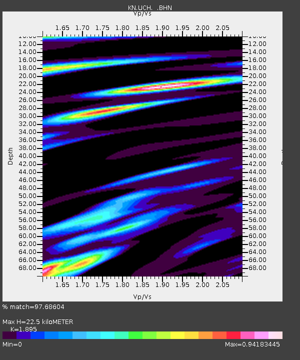
UCH KN.UCH - Earthquake Result Viewer
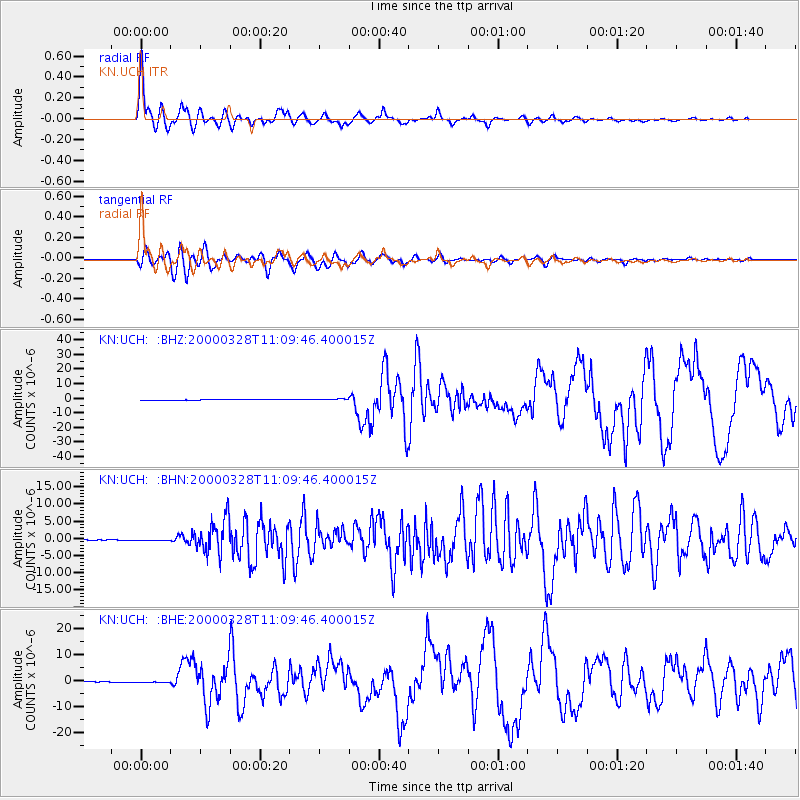
Earthquake location: Volcano Islands, Japan Region
Earthquake latitude/longitude: 22.3/143.7
Earthquake time(UTC): 2000/03/28 (088) 11:00:22 GMT
Earthquake Depth: 126 km
Earthquake Magnitude: 6.8 MB, 7.6 MS, 7.6 MW, 7.6 MW
Earthquake Catalog/Contributor: WHDF/NEIC
Network: KN Kyrgyz Seismic Telemetry Network
Station: UCH KN.UCH
Lat/Lon: 42.23 N/74.51 E
Elevation: 3850 m
Distance: 60.2 deg
Az: 306.847 deg
Baz: 85.99 deg
Ray Param: 0.06131283
Estimated Moho Depth: 22.5 km
Estimated Crust Vp/Vs: 1.89
Assumed Crust Vp: 6.306 km/s
Estimated Crust Vs: 3.328 km/s
Estimated Crust Poisson's Ratio: 0.31
Radial Match: 97.68604 %
Radial Bump: 400
Transverse Match: 94.549065 %
Transverse Bump: 400
SOD ConfigId: 3744
Insert Time: 2010-03-08 21:21:23.606 +0000
GWidth: 2.5
Max Bumps: 400
Tol: 0.001

Signal To Noise

ChannelStoNSTALTA
KN:UCH: :BHN:20000328T11:09:46.400015Z2.43143689.060428E-83.726368E-8
KN:UCH: :BHE:20000328T11:09:46.400015Z2.94329763.51162E-71.1930902E-7
KN:UCH: :BHZ:20000328T11:09:46.400015Z2.73153385.1624573E-71.8899482E-7
Arrivals
Ps3.3 SECOND
PpPs9.9 SECOND
PsPs/PpSs13 SECOND