VTV Victorville, California, USA - Earthquake Result Viewer
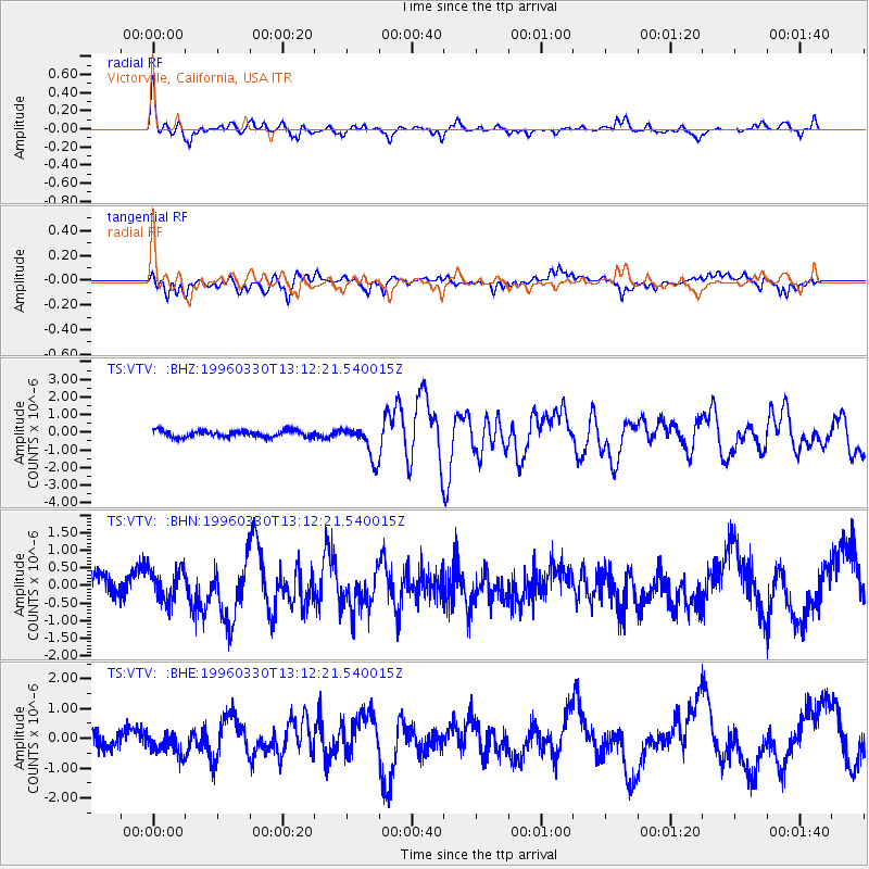
Earthquake location: Fox Islands, Aleutian Islands
Earthquake latitude/longitude: 52.2/-168.7
Earthquake time(UTC): 1996/03/30 (090) 13:05:17 GMT
Earthquake Depth: 33 km
Earthquake Magnitude: 5.9 MB, 6.2 MS, 6.3 UNKNOWN, 6.1 ML
Earthquake Catalog/Contributor: WHDF/NEIC
Network: TS TERRAscope (Southern California Seismic Network)
Station: VTV Victorville, California, USA
Lat/Lon: 34.57 N/117.33 W
Elevation: 847 m
Distance: 40.4 deg
Az: 95.169 deg
Baz: 312.051 deg
Ray Param: 0.074384846
Estimated Moho Depth: 10.0 km
Estimated Crust Vp/Vs: 1.88
Assumed Crust Vp: 6.276 km/s
Estimated Crust Vs: 3.338 km/s
Estimated Crust Poisson's Ratio: 0.30
Radial Match: 81.369865 %
Radial Bump: 400
Transverse Match: 75.09379 %
Transverse Bump: 400
SOD ConfigId: 6273
Insert Time: 2010-02-26 14:54:18.620 +0000
GWidth: 2.5
Max Bumps: 400
Tol: 0.001

Signal To Noise

ChannelStoNSTALTA
TS:VTV: :BHN:19960330T13:12:21.540015Z1.53563254.6750603E-73.0443874E-7
TS:VTV: :BHE:19960330T13:12:21.540015Z1.23649953.7330298E-73.0190307E-7
TS:VTV: :BHZ:19960330T13:12:21.540015Z5.1553739.46789E-71.8365091E-7
Arrivals
Ps1.5 SECOND
PpPs4.3 SECOND
PsPs/PpSs5.8 SECOND