You are here: Home > Network List > CI - Caltech Regional Seismic Network Stations List
> Station GLA Glamis, Glamis, CA, USA > Earthquake Result Viewer
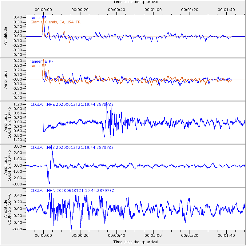
GLA Glamis, Glamis, CA, USA - Earthquake Result Viewer
*The percent match for this event was below the threshold and hence no stack was calculated.
| Earthquake location: |
Mariana Islands |
| Earthquake latitude/longitude: |
18.9/145.1 |
| Earthquake time(UTC): |
2020/06/13 (165) 21:08:30 GMT |
| Earthquake Depth: |
622 km |
| Earthquake Magnitude: |
6.2 Mww |
| Earthquake Catalog/Contributor: |
NEIC PDE/us |
|
| Network: |
CI Caltech Regional Seismic Network |
| Station: |
GLA Glamis, Glamis, CA, USA |
| Lat/Lon: |
33.05 N/114.83 W |
| Elevation: |
610 m |
|
| Distance: |
87.9 deg |
| Az: |
55.84 deg |
| Baz: |
291.152 deg |
| Ray Param: |
$rayparam |
*The percent match for this event was below the threshold and hence was not used in the summary stack. |
|
| Radial Match: |
73.676125 % |
| Radial Bump: |
400 |
| Transverse Match: |
53.50579 % |
| Transverse Bump: |
400 |
| SOD ConfigId: |
21709731 |
| Insert Time: |
2020-06-27 21:18:00.134 +0000 |
| GWidth: |
2.5 |
| Max Bumps: |
400 |
| Tol: |
0.001 |
|
Signal To Noise
| Channel | StoN | STA | LTA |
| CI:GLA: :HHZ:20200613T21:19:44.287973Z | 23.500597 | 1.4038242E-6 | 5.973568E-8 |
| CI:GLA: :HHN:20200613T21:19:44.287973Z | 1.5176564 | 2.051729E-7 | 1.3519062E-7 |
| CI:GLA: :HHE:20200613T21:19:44.287973Z | 2.6184525 | 4.802916E-7 | 1.8342574E-7 |
| Arrivals |
| Ps | |
| PpPs | |
| PsPs/PpSs | |


