UCH KN.UCH - Earthquake Result Viewer
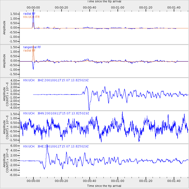
Earthquake location: Irian Jaya Region, Indonesia
Earthquake latitude/longitude: -0.6/133.1
Earthquake time(UTC): 2001/09/11 (254) 14:56:50 GMT
Earthquake Depth: 33 km
Earthquake Magnitude: 5.8 MB, 6.4 MS, 6.6 MW, 6.5 MW
Earthquake Catalog/Contributor: WHDF/NEIC
Network: KN Kyrgyz Seismic Telemetry Network
Station: UCH KN.UCH
Lat/Lon: 42.23 N/74.51 E
Elevation: 3850 m
Distance: 67.7 deg
Az: 316.725 deg
Baz: 112.645 deg
Ray Param: 0.0567587
Estimated Moho Depth: 49.5 km
Estimated Crust Vp/Vs: 1.96
Assumed Crust Vp: 6.306 km/s
Estimated Crust Vs: 3.213 km/s
Estimated Crust Poisson's Ratio: 0.32
Radial Match: 98.58474 %
Radial Bump: 150
Transverse Match: 85.23707 %
Transverse Bump: 400
SOD ConfigId: 20082
Insert Time: 2010-03-08 21:21:58.695 +0000
GWidth: 2.5
Max Bumps: 400
Tol: 0.001

Signal To Noise

ChannelStoNSTALTA
KN:UCH: :BHN:20010911T15:07:13.825029Z0.7824033.1886955E-74.0755157E-7
KN:UCH: :BHE:20010911T15:07:13.825029Z1.98068117.372563E-83.7222364E-8
KN:UCH: :BHZ:20010911T15:07:13.825029Z1.94883455.6548394E-82.9016519E-8
Arrivals
Ps7.8 SECOND
PpPs22 SECOND
PsPs/PpSs30 SECOND