UCH KN.UCH - Earthquake Result Viewer
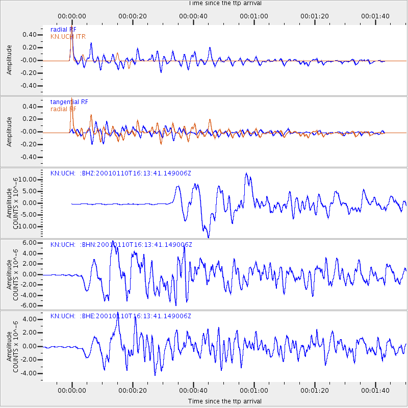
Earthquake location: Kodiak Island Region, Alaska
Earthquake latitude/longitude: 57.1/-153.2
Earthquake time(UTC): 2001/01/10 (010) 16:02:44 GMT
Earthquake Depth: 33 km
Earthquake Magnitude: 6.2 MB, 6.8 MS, 7.1 MW, 6.8 ML
Earthquake Catalog/Contributor: WHDF/NEIC
Network: KN Kyrgyz Seismic Telemetry Network
Station: UCH KN.UCH
Lat/Lon: 42.23 N/74.51 E
Elevation: 3850 m
Distance: 73.3 deg
Az: 324.978 deg
Baz: 24.957 deg
Ray Param: 0.053077623
Estimated Moho Depth: 56.0 km
Estimated Crust Vp/Vs: 1.70
Assumed Crust Vp: 6.306 km/s
Estimated Crust Vs: 3.715 km/s
Estimated Crust Poisson's Ratio: 0.23
Radial Match: 94.63195 %
Radial Bump: 400
Transverse Match: 85.81645 %
Transverse Bump: 400
SOD ConfigId: 3744
Insert Time: 2010-03-08 21:22:24.085 +0000
GWidth: 2.5
Max Bumps: 400
Tol: 0.001

Signal To Noise

ChannelStoNSTALTA
KN:UCH: :BHN:20010110T16:13:41.149006Z10.7684981.0769126E-61.0000583E-7
KN:UCH: :BHE:20010110T16:13:41.149006Z7.240615.3113763E-77.335537E-8
KN:UCH: :BHZ:20010110T16:13:41.149006Z22.5378342.7408303E-61.2161019E-7
Arrivals
Ps6.4 SECOND
PpPs23 SECOND
PsPs/PpSs30 SECOND