UCH KN.UCH - Earthquake Result Viewer
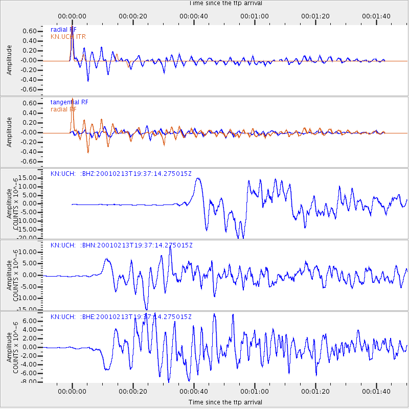
Earthquake location: Southern Sumatra, Indonesia
Earthquake latitude/longitude: -4.7/102.6
Earthquake time(UTC): 2001/02/13 (044) 19:28:30 GMT
Earthquake Depth: 36 km
Earthquake Magnitude: 6.2 MB, 7.2 MS, 7.4 MW, 7.0 ME
Earthquake Catalog/Contributor: WHDF/NEIC
Network: KN Kyrgyz Seismic Telemetry Network
Station: UCH KN.UCH
Lat/Lon: 42.23 N/74.51 E
Elevation: 3850 m
Distance: 53.2 deg
Az: 334.14 deg
Baz: 144.174 deg
Ray Param: 0.066188976
Estimated Moho Depth: 10.0 km
Estimated Crust Vp/Vs: 1.77
Assumed Crust Vp: 6.306 km/s
Estimated Crust Vs: 3.568 km/s
Estimated Crust Poisson's Ratio: 0.26
Radial Match: 96.36385 %
Radial Bump: 400
Transverse Match: 87.01673 %
Transverse Bump: 400
SOD ConfigId: 3744
Insert Time: 2010-03-08 21:22:28.905 +0000
GWidth: 2.5
Max Bumps: 400
Tol: 0.001

Signal To Noise

ChannelStoNSTALTA
KN:UCH: :BHN:20010213T19:37:14.275015Z1.80151121.5685478E-78.706844E-8
KN:UCH: :BHE:20010213T19:37:14.275015Z1.46828471.4140551E-79.63066E-8
KN:UCH: :BHZ:20010213T19:37:14.275015Z2.44982812.874469E-71.173335E-7
Arrivals
Ps1.3 SECOND
PpPs4.2 SECOND
PsPs/PpSs5.4 SECOND