
UCH KN.UCH - Earthquake Result Viewer
| ||||||||||||||||||
| ||||||||||||||||||
| ||||||||||||||||||
|
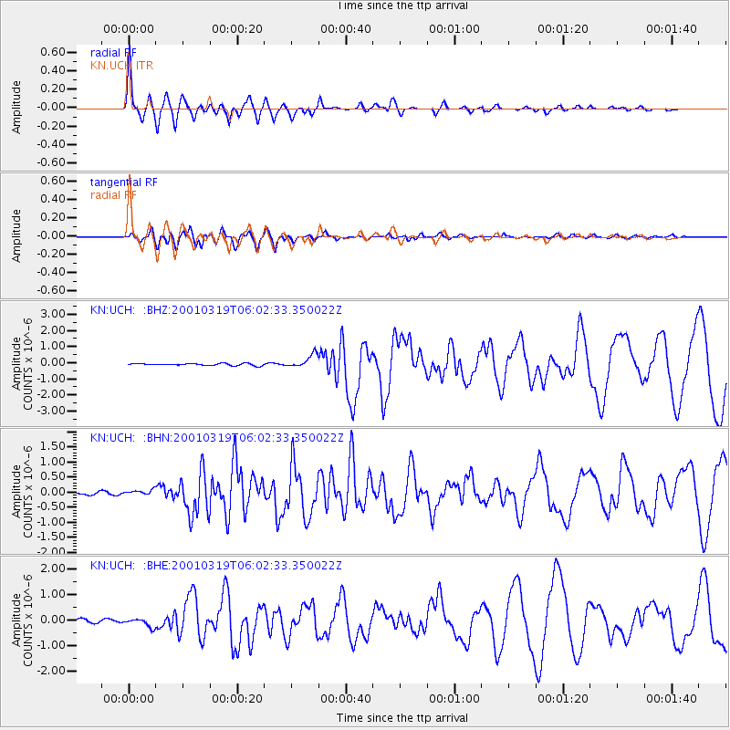
Signal To Noise
| Channel | StoN | STA | LTA |
| KN:UCH: :BHN:20010319T06:02:33.350022Z | 1.721887 | 8.089009E-8 | 4.6977583E-8 |
| KN:UCH: :BHE:20010319T06:02:33.350022Z | 2.6835988 | 1.6831949E-7 | 6.2721554E-8 |
| KN:UCH: :BHZ:20010319T06:02:33.350022Z | 6.6145372 | 4.0971665E-7 | 6.194185E-8 |
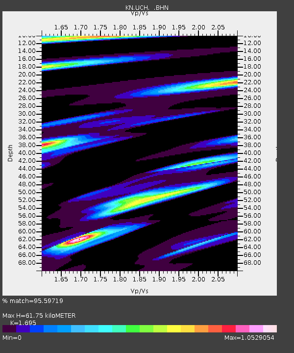
| Arrivals | |
| Ps | 7.1 SECOND |
| PpPs | 25 SECOND |
| PsPs/PpSs | 32 SECOND |

