
UCH KN.UCH - Earthquake Result Viewer
| ||||||||||||||||||
| ||||||||||||||||||
| ||||||||||||||||||
|
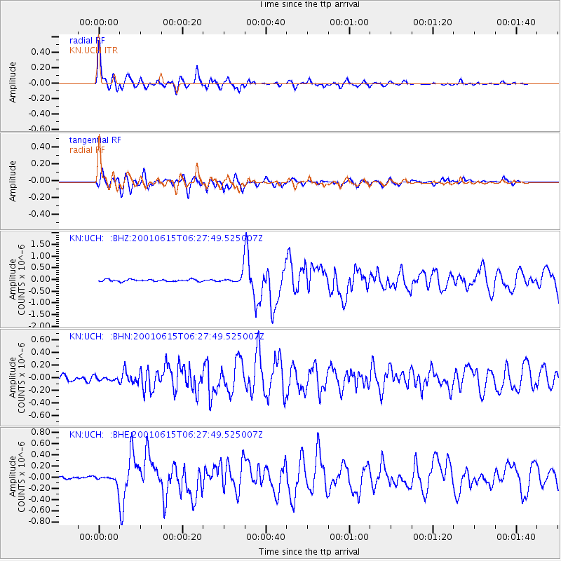
Signal To Noise
| Channel | StoN | STA | LTA |
| KN:UCH: :BHN:20010615T06:27:49.525007Z | 0.5136519 | 2.6141294E-8 | 5.089301E-8 |
| KN:UCH: :BHE:20010615T06:27:49.525007Z | 3.928942 | 9.246966E-8 | 2.3535513E-8 |
| KN:UCH: :BHZ:20010615T06:27:49.525007Z | 6.2317405 | 2.5898322E-7 | 4.155873E-8 |
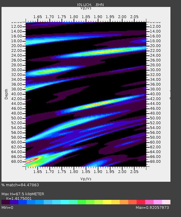
| Arrivals | |
| Ps | 6.9 SECOND |
| PpPs | 27 SECOND |
| PsPs/PpSs | 34 SECOND |

