You are here: Home > Network List > TX - Texas Seismological Network Stations List
> Station WTFS Witchita Falls > Earthquake Result Viewer
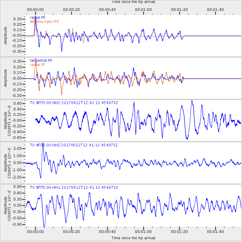
WTFS Witchita Falls - Earthquake Result Viewer
*The percent match for this event was below the threshold and hence no stack was calculated.
| Earthquake location: |
Aegean Sea |
| Earthquake latitude/longitude: |
38.9/26.4 |
| Earthquake time(UTC): |
2017/06/12 (163) 12:28:38 GMT |
| Earthquake Depth: |
10 km |
| Earthquake Magnitude: |
6.3 Mww |
| Earthquake Catalog/Contributor: |
NEIC PDE/us |
|
| Network: |
TX Texas Seismological Network |
| Station: |
WTFS Witchita Falls |
| Lat/Lon: |
33.77 N/98.46 W |
| Elevation: |
277 m |
|
| Distance: |
91.4 deg |
| Az: |
316.841 deg |
| Baz: |
39.824 deg |
| Ray Param: |
$rayparam |
*The percent match for this event was below the threshold and hence was not used in the summary stack. |
|
| Radial Match: |
73.2544 % |
| Radial Bump: |
372 |
| Transverse Match: |
54.747093 % |
| Transverse Bump: |
256 |
| SOD ConfigId: |
2140511 |
| Insert Time: |
2017-06-26 04:28:51.266 +0000 |
| GWidth: |
2.5 |
| Max Bumps: |
400 |
| Tol: |
0.001 |
|
Signal To Noise
| Channel | StoN | STA | LTA |
| TX:WTFS:00:HHZ:20170612T12:41:13.454973Z | 15.0113735 | 1.238654E-6 | 8.251437E-8 |
| TX:WTFS:00:HH1:20170612T12:41:13.454973Z | 2.4867935 | 4.038346E-7 | 1.6239169E-7 |
| TX:WTFS:00:HH2:20170612T12:41:13.454973Z | 1.6039848 | 2.3182109E-7 | 1.4452823E-7 |
| Arrivals |
| Ps | |
| PpPs | |
| PsPs/PpSs | |


