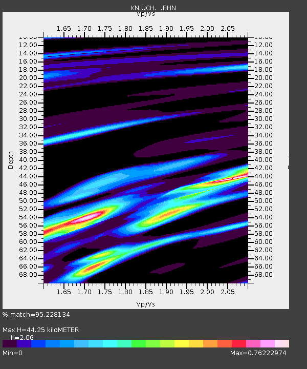
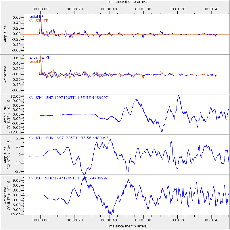
UCH KN.UCH - Earthquake Result Viewer

Earthquake location: Near East Coast Of Kamchatka
Earthquake latitude/longitude: 54.8/162.0
Earthquake time(UTC): 1997/12/05 (339) 11:26:54 GMT
Earthquake Depth: 33 km
Earthquake Magnitude: 6.3 MB, 7.6 MS, 7.9 UNKNOWN, 7.3 ME
Earthquake Catalog/Contributor: WHDF/NEIC
Network: KN Kyrgyz Seismic Telemetry Network
Station: UCH KN.UCH
Lat/Lon: 42.23 N/74.51 E
Elevation: 3850 m
Distance: 55.6 deg
Az: 295.95 deg
Baz: 44.449 deg
Ray Param: 0.06462029
Estimated Moho Depth: 44.25 km
Estimated Crust Vp/Vs: 2.06
Assumed Crust Vp: 6.306 km/s
Estimated Crust Vs: 3.061 km/s
Estimated Crust Poisson's Ratio: 0.35
Radial Match: 95.228134 %
Radial Bump: 310
Transverse Match: 85.271866 %
Transverse Bump: 400
SOD ConfigId: 4480
Insert Time: 2010-03-08 21:23:16.069 +0000
GWidth: 2.5
Max Bumps: 400
Tol: 0.001

Signal To Noise

ChannelStoNSTALTA
KN:UCH: :BHN:19971205T11:35:56.448999Z7.677782.7653416E-63.6017462E-7
KN:UCH: :BHE:19971205T11:35:56.448999Z3.68345679.254116E-72.5123455E-7
KN:UCH: :BHZ:19971205T11:35:56.448999Z2.87584169.938713E-73.4559318E-7
Arrivals
Ps7.8 SECOND
PpPs21 SECOND
PsPs/PpSs28 SECOND