You are here: Home > Network List > US - United States National Seismic Network Stations List
> Station HAWA Hanford, Washington, USA > Earthquake Result Viewer
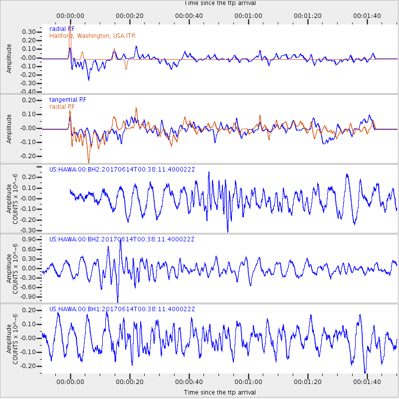
HAWA Hanford, Washington, USA - Earthquake Result Viewer
*The percent match for this event was below the threshold and hence no stack was calculated.
| Earthquake location: |
Vanuatu Islands |
| Earthquake latitude/longitude: |
-18.3/168.7 |
| Earthquake time(UTC): |
2017/06/14 (165) 00:25:40 GMT |
| Earthquake Depth: |
23 km |
| Earthquake Magnitude: |
5.8 mb |
| Earthquake Catalog/Contributor: |
NEIC PDE/us |
|
| Network: |
US United States National Seismic Network |
| Station: |
HAWA Hanford, Washington, USA |
| Lat/Lon: |
46.39 N/119.53 W |
| Elevation: |
364 m |
|
| Distance: |
91.1 deg |
| Az: |
41.121 deg |
| Baz: |
244.531 deg |
| Ray Param: |
$rayparam |
*The percent match for this event was below the threshold and hence was not used in the summary stack. |
|
| Radial Match: |
44.988663 % |
| Radial Bump: |
400 |
| Transverse Match: |
36.968845 % |
| Transverse Bump: |
400 |
| SOD ConfigId: |
2140511 |
| Insert Time: |
2017-06-27 16:22:27.706 +0000 |
| GWidth: |
2.5 |
| Max Bumps: |
400 |
| Tol: |
0.001 |
|
Signal To Noise
| Channel | StoN | STA | LTA |
| US:HAWA:00:BHZ:20170614T00:38:11.400022Z | 2.4945934 | 2.3772164E-7 | 9.5294745E-8 |
| US:HAWA:00:BH1:20170614T00:38:11.400022Z | 1.3140107 | 8.714495E-8 | 6.6319814E-8 |
| US:HAWA:00:BH2:20170614T00:38:11.400022Z | 1.4282279 | 1.1157869E-7 | 7.812387E-8 |
| Arrivals |
| Ps | |
| PpPs | |
| PsPs/PpSs | |


