You are here: Home > Network List > US - United States National Seismic Network Stations List
> Station EGMT Eagleton, Montana, USA > Earthquake Result Viewer
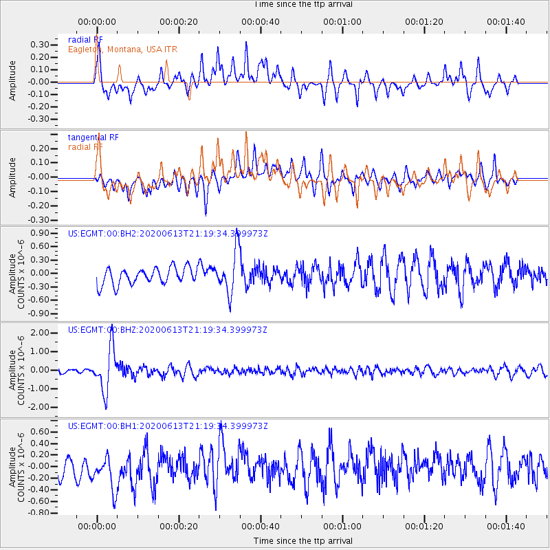
EGMT Eagleton, Montana, USA - Earthquake Result Viewer
*The percent match for this event was below the threshold and hence no stack was calculated.
| Earthquake location: |
Mariana Islands |
| Earthquake latitude/longitude: |
18.9/145.1 |
| Earthquake time(UTC): |
2020/06/13 (165) 21:08:30 GMT |
| Earthquake Depth: |
622 km |
| Earthquake Magnitude: |
6.2 Mww |
| Earthquake Catalog/Contributor: |
NEIC PDE/us |
|
| Network: |
US United States National Seismic Network |
| Station: |
EGMT Eagleton, Montana, USA |
| Lat/Lon: |
48.02 N/109.75 W |
| Elevation: |
1055 m |
|
| Distance: |
85.8 deg |
| Az: |
40.523 deg |
| Baz: |
293.624 deg |
| Ray Param: |
$rayparam |
*The percent match for this event was below the threshold and hence was not used in the summary stack. |
|
| Radial Match: |
64.57623 % |
| Radial Bump: |
400 |
| Transverse Match: |
53.149826 % |
| Transverse Bump: |
400 |
| SOD ConfigId: |
21709731 |
| Insert Time: |
2020-06-27 21:31:52.722 +0000 |
| GWidth: |
2.5 |
| Max Bumps: |
400 |
| Tol: |
0.001 |
|
Signal To Noise
| Channel | StoN | STA | LTA |
| US:EGMT:00:BHZ:20200613T21:19:34.399973Z | 17.045313 | 1.2167136E-6 | 7.138113E-8 |
| US:EGMT:00:BH1:20200613T21:19:34.399973Z | 2.25742 | 3.5803373E-7 | 1.5860306E-7 |
| US:EGMT:00:BH2:20200613T21:19:34.399973Z | 2.624002 | 4.880126E-7 | 1.8598027E-7 |
| Arrivals |
| Ps | |
| PpPs | |
| PsPs/PpSs | |


