You are here: Home > Network List > US - United States National Seismic Network Stations List
> Station LAO LASA Array, Montana, USA > Earthquake Result Viewer
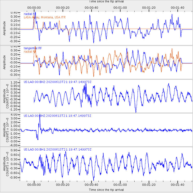
LAO LASA Array, Montana, USA - Earthquake Result Viewer
*The percent match for this event was below the threshold and hence no stack was calculated.
| Earthquake location: |
Mariana Islands |
| Earthquake latitude/longitude: |
18.9/145.1 |
| Earthquake time(UTC): |
2020/06/13 (165) 21:08:30 GMT |
| Earthquake Depth: |
622 km |
| Earthquake Magnitude: |
6.2 Mww |
| Earthquake Catalog/Contributor: |
NEIC PDE/us |
|
| Network: |
US United States National Seismic Network |
| Station: |
LAO LASA Array, Montana, USA |
| Lat/Lon: |
46.69 N/106.22 W |
| Elevation: |
902 m |
|
| Distance: |
88.5 deg |
| Az: |
40.723 deg |
| Baz: |
296.224 deg |
| Ray Param: |
$rayparam |
*The percent match for this event was below the threshold and hence was not used in the summary stack. |
|
| Radial Match: |
70.56122 % |
| Radial Bump: |
400 |
| Transverse Match: |
83.79689 % |
| Transverse Bump: |
400 |
| SOD ConfigId: |
21709731 |
| Insert Time: |
2020-06-27 21:32:01.496 +0000 |
| GWidth: |
2.5 |
| Max Bumps: |
400 |
| Tol: |
0.001 |
|
Signal To Noise
| Channel | StoN | STA | LTA |
| US:LAO:00:BHZ:20200613T21:19:47.149973Z | 7.6334414 | 1.5071378E-6 | 1.9743884E-7 |
| US:LAO:00:BH1:20200613T21:19:47.149973Z | 1.2055732 | 2.599011E-7 | 2.15583E-7 |
| US:LAO:00:BH2:20200613T21:19:47.149973Z | 1.1309371 | 4.1566008E-7 | 3.67536E-7 |
| Arrivals |
| Ps | |
| PpPs | |
| PsPs/PpSs | |


