You are here: Home > Network List > US - United States National Seismic Network Stations List
> Station MNTX Cornudas Mountains, Texas, USA > Earthquake Result Viewer
MNTX Cornudas Mountains, Texas, USA - Earthquake Result Viewer
*The percent match for this event was below the threshold and hence no stack was calculated.
| Earthquake location: |
Mariana Islands |
| Earthquake latitude/longitude: |
18.9/145.1 |
| Earthquake time(UTC): |
2020/06/13 (165) 21:08:30 GMT |
| Earthquake Depth: |
622 km |
| Earthquake Magnitude: |
6.2 Mww |
| Earthquake Catalog/Contributor: |
NEIC PDE/us |
|
| Network: |
US United States National Seismic Network |
| Station: |
MNTX Cornudas Mountains, Texas, USA |
| Lat/Lon: |
31.70 N/105.38 W |
| Elevation: |
404 m |
|
| Distance: |
95.8 deg |
| Az: |
53.861 deg |
| Baz: |
296.258 deg |
| Ray Param: |
$rayparam |
*The percent match for this event was below the threshold and hence was not used in the summary stack. |
|
| Radial Match: |
46.638706 % |
| Radial Bump: |
400 |
| Transverse Match: |
66.21542 % |
| Transverse Bump: |
383 |
| SOD ConfigId: |
21709731 |
| Insert Time: |
2020-06-27 21:32:02.096 +0000 |
| GWidth: |
2.5 |
| Max Bumps: |
400 |
| Tol: |
0.001 |
|
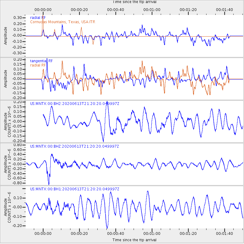
Signal To Noise
| Channel | StoN | STA | LTA |
| US:MNTX:00:BHZ:20200613T21:20:20.049997Z | 4.9619393 | 3.504714E-7 | 7.063194E-8 |
| US:MNTX:00:BH1:20200613T21:20:20.049997Z | 1.2351798 | 5.316915E-8 | 4.3045677E-8 |
| US:MNTX:00:BH2:20200613T21:20:20.049997Z | 1.9121634 | 9.769703E-8 | 5.1092407E-8 |
| Arrivals |
| Ps | |
| PpPs | |
| PsPs/PpSs | |


