You are here: Home > Network List > UU - University of Utah Regional Network Stations List
> Station FORU South Mineral Mountains, UT, USA > Earthquake Result Viewer
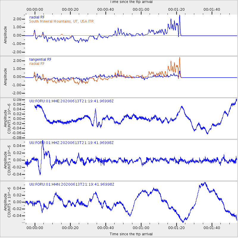
FORU South Mineral Mountains, UT, USA - Earthquake Result Viewer
*The percent match for this event was below the threshold and hence no stack was calculated.
| Earthquake location: |
Mariana Islands |
| Earthquake latitude/longitude: |
18.9/145.1 |
| Earthquake time(UTC): |
2020/06/13 (165) 21:08:30 GMT |
| Earthquake Depth: |
622 km |
| Earthquake Magnitude: |
6.2 Mww |
| Earthquake Catalog/Contributor: |
NEIC PDE/us |
|
| Network: |
UU University of Utah Regional Network |
| Station: |
FORU South Mineral Mountains, UT, USA |
| Lat/Lon: |
38.46 N/112.86 W |
| Elevation: |
1840 m |
|
| Distance: |
87.4 deg |
| Az: |
50.231 deg |
| Baz: |
292.07 deg |
| Ray Param: |
$rayparam |
*The percent match for this event was below the threshold and hence was not used in the summary stack. |
|
| Radial Match: |
46.02487 % |
| Radial Bump: |
400 |
| Transverse Match: |
45.397953 % |
| Transverse Bump: |
400 |
| SOD ConfigId: |
21709731 |
| Insert Time: |
2020-06-27 21:32:35.606 +0000 |
| GWidth: |
2.5 |
| Max Bumps: |
400 |
| Tol: |
0.001 |
|
Signal To Noise
| Channel | StoN | STA | LTA |
| UU:FORU:01:HHZ:20200613T21:19:41.96998Z | 4.676606 | 2.4047006E-8 | 5.141978E-9 |
| UU:FORU:01:HHN:20200613T21:19:41.96998Z | 0.5656396 | 9.27891E-9 | 1.6404279E-8 |
| UU:FORU:01:HHE:20200613T21:19:41.96998Z | 0.7058773 | 1.7511658E-8 | 2.480836E-8 |
| Arrivals |
| Ps | |
| PpPs | |
| PsPs/PpSs | |


