UCH KN.UCH - Earthquake Result Viewer
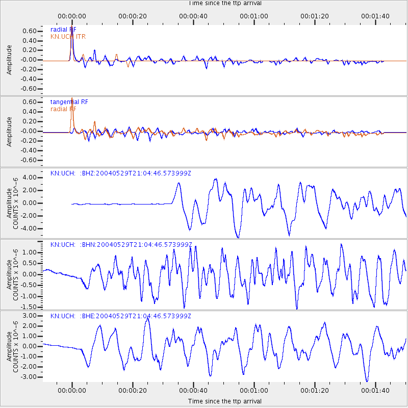
Earthquake location: Off East Coast Of Honshu, Japan
Earthquake latitude/longitude: 34.3/141.4
Earthquake time(UTC): 2004/05/29 (150) 20:56:09 GMT
Earthquake Depth: 16 km
Earthquake Magnitude: 5.6 MB, 6.6 MS, 6.5 MW, 6.3 MW
Earthquake Catalog/Contributor: WHDF/NEIC
Network: KN Kyrgyz Seismic Telemetry Network
Station: UCH KN.UCH
Lat/Lon: 42.23 N/74.51 E
Elevation: 3850 m
Distance: 51.9 deg
Az: 299.807 deg
Baz: 75.402 deg
Ray Param: 0.06707216
Estimated Moho Depth: 57.5 km
Estimated Crust Vp/Vs: 1.78
Assumed Crust Vp: 6.306 km/s
Estimated Crust Vs: 3.538 km/s
Estimated Crust Poisson's Ratio: 0.27
Radial Match: 94.87892 %
Radial Bump: 369
Transverse Match: 82.53581 %
Transverse Bump: 400
SOD ConfigId: 2459
Insert Time: 2010-03-08 21:25:08.417 +0000
GWidth: 2.5
Max Bumps: 400
Tol: 0.001

Signal To Noise

ChannelStoNSTALTA
KN:UCH: :BHN:20040529T21:04:46.573999Z0.75739672.3483959E-73.1006155E-7
KN:UCH: :BHE:20040529T21:04:46.573999Z1.79346055.492325E-73.0624173E-7
KN:UCH: :BHZ:20040529T21:04:46.573999Z25.9817589.821571E-73.7801794E-8
Arrivals
Ps7.5 SECOND
PpPs24 SECOND
PsPs/PpSs32 SECOND