UCH KN.UCH - Earthquake Result Viewer
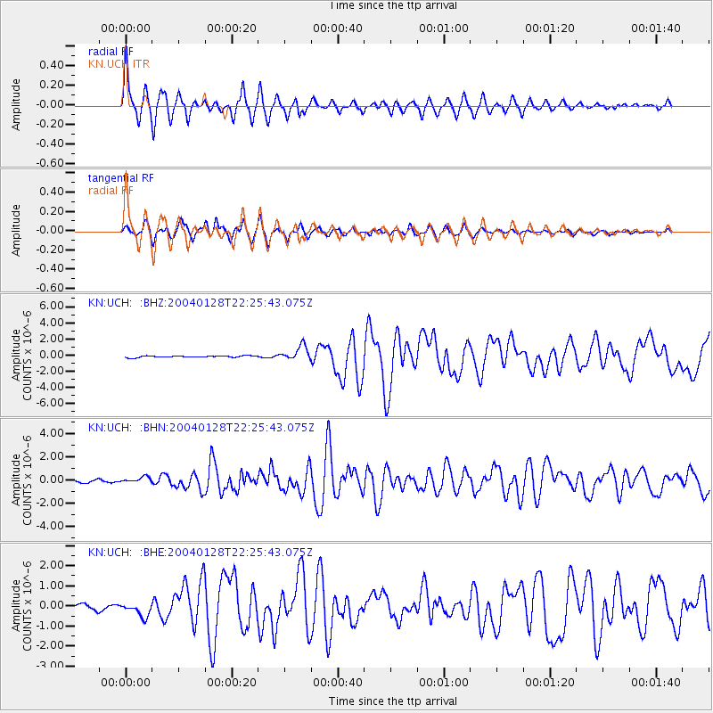
Earthquake location: Seram, Indonesia
Earthquake latitude/longitude: -3.1/127.4
Earthquake time(UTC): 2004/01/28 (028) 22:15:30 GMT
Earthquake Depth: 17 km
Earthquake Magnitude: 6.0 MB, 6.5 MS, 6.7 MW, 6.6 MW
Earthquake Catalog/Contributor: WHDF/NEIC
Network: KN Kyrgyz Seismic Telemetry Network
Station: UCH KN.UCH
Lat/Lon: 42.23 N/74.51 E
Elevation: 3850 m
Distance: 65.7 deg
Az: 319.475 deg
Baz: 119.122 deg
Ray Param: 0.058075193
Estimated Moho Depth: 61.0 km
Estimated Crust Vp/Vs: 1.74
Assumed Crust Vp: 6.306 km/s
Estimated Crust Vs: 3.619 km/s
Estimated Crust Poisson's Ratio: 0.25
Radial Match: 94.14124 %
Radial Bump: 400
Transverse Match: 89.78504 %
Transverse Bump: 400
SOD ConfigId: 2459
Insert Time: 2010-03-08 21:25:23.722 +0000
GWidth: 2.5
Max Bumps: 400
Tol: 0.001

Signal To Noise

ChannelStoNSTALTA
KN:UCH: :BHN:20040128T22:25:43.075Z2.4336782.8891222E-71.1871425E-7
KN:UCH: :BHE:20040128T22:25:43.075Z2.56585813.438997E-71.3402912E-7
KN:UCH: :BHZ:20040128T22:25:43.075Z9.0600789.0365086E-79.973986E-8
Arrivals
Ps7.5 SECOND
PpPs25 SECOND
PsPs/PpSs33 SECOND