UCH KN.UCH - Earthquake Result Viewer
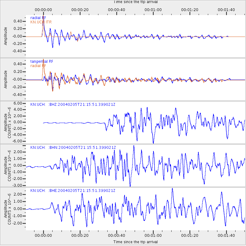
Earthquake location: Irian Jaya Region, Indonesia
Earthquake latitude/longitude: -3.6/135.5
Earthquake time(UTC): 2004/02/05 (036) 21:05:02 GMT
Earthquake Depth: 17 km
Earthquake Magnitude: 6.1 MB, 7.1 MS, 7.0 MW, 6.8 MW
Earthquake Catalog/Contributor: WHDF/NEIC
Network: KN Kyrgyz Seismic Telemetry Network
Station: UCH KN.UCH
Lat/Lon: 42.23 N/74.51 E
Elevation: 3850 m
Distance: 71.5 deg
Az: 316.754 deg
Baz: 112.98 deg
Ray Param: 0.054267664
Estimated Moho Depth: 10.0 km
Estimated Crust Vp/Vs: 1.68
Assumed Crust Vp: 6.306 km/s
Estimated Crust Vs: 3.748 km/s
Estimated Crust Poisson's Ratio: 0.23
Radial Match: 94.93285 %
Radial Bump: 400
Transverse Match: 86.47646 %
Transverse Bump: 400
SOD ConfigId: 2459
Insert Time: 2010-03-08 21:25:25.547 +0000
GWidth: 2.5
Max Bumps: 400
Tol: 0.001

Signal To Noise

ChannelStoNSTALTA
KN:UCH: :BHN:20040205T21:15:51.399021Z1.75595812.1804317E-71.2417334E-7
KN:UCH: :BHE:20040205T21:15:51.399021Z4.66813043.6589336E-77.8381134E-8
KN:UCH: :BHZ:20040205T21:15:51.399021Z10.187397.682181E-77.540872E-8
Arrivals
Ps1.1 SECOND
PpPs4.1 SECOND
PsPs/PpSs5.2 SECOND