You are here: Home > Network List > IW - Intermountain West Stations List
> Station MOOW Moose Ponds, Wyoming, USA > Earthquake Result Viewer
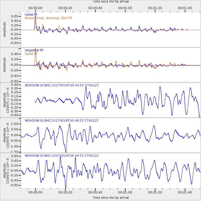
MOOW Moose Ponds, Wyoming, USA - Earthquake Result Viewer
*The percent match for this event was below the threshold and hence no stack was calculated.
| Earthquake location: |
Near Coast Of Chiapas, Mexico |
| Earthquake latitude/longitude: |
14.2/-93.2 |
| Earthquake time(UTC): |
2017/06/14 (165) 06:38:48 GMT |
| Earthquake Depth: |
11 km |
| Earthquake Magnitude: |
5.5 Mww |
| Earthquake Catalog/Contributor: |
NEIC PDE/us |
|
| Network: |
IW Intermountain West |
| Station: |
MOOW Moose Ponds, Wyoming, USA |
| Lat/Lon: |
43.75 N/110.74 W |
| Elevation: |
2128 m |
|
| Distance: |
33.1 deg |
| Az: |
336.321 deg |
| Baz: |
147.493 deg |
| Ray Param: |
$rayparam |
*The percent match for this event was below the threshold and hence was not used in the summary stack. |
|
| Radial Match: |
77.94386 % |
| Radial Bump: |
400 |
| Transverse Match: |
74.74867 % |
| Transverse Bump: |
400 |
| SOD ConfigId: |
2140511 |
| Insert Time: |
2017-06-27 22:31:55.819 +0000 |
| GWidth: |
2.5 |
| Max Bumps: |
400 |
| Tol: |
0.001 |
|
Signal To Noise
| Channel | StoN | STA | LTA |
| IW:MOOW:00:BHZ:20170614T06:44:53.579012Z | 7.4511 | 5.8945767E-7 | 7.911015E-8 |
| IW:MOOW:00:BH1:20170614T06:44:53.579012Z | 5.43752 | 2.7606077E-7 | 5.076961E-8 |
| IW:MOOW:00:BH2:20170614T06:44:53.579012Z | 4.611349 | 1.71521E-7 | 3.7195406E-8 |
| Arrivals |
| Ps | |
| PpPs | |
| PsPs/PpSs | |


