
UCH KN.UCH - Earthquake Result Viewer
| ||||||||||||||||||
| ||||||||||||||||||
| ||||||||||||||||||
|
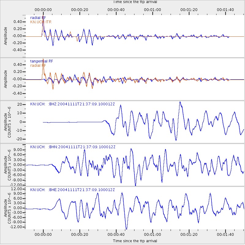
Signal To Noise
| Channel | StoN | STA | LTA |
| KN:UCH: :BHN:20041111T21:37:09.100012Z | 2.7472286 | 2.5516678E-7 | 9.288152E-8 |
| KN:UCH: :BHE:20041111T21:37:09.100012Z | 3.6624355 | 3.5207876E-7 | 9.613242E-8 |
| KN:UCH: :BHZ:20041111T21:37:09.100012Z | 6.1997795 | 9.776351E-7 | 1.5768869E-7 |
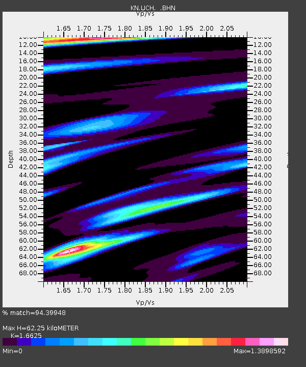
| Arrivals | |
| Ps | 6.8 SECOND |
| PpPs | 25 SECOND |
| PsPs/PpSs | 32 SECOND |

