You are here: Home > Network List > AV - Alaska Volcano Observatory Stations List
> Station PLBL Mt. Peulik Volcano, Alaska > Earthquake Result Viewer
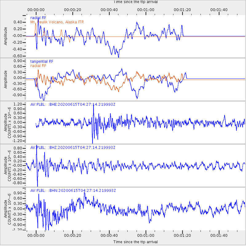
PLBL Mt. Peulik Volcano, Alaska - Earthquake Result Viewer
*The percent match for this event was below the threshold and hence no stack was calculated.
| Earthquake location: |
Halmahera, Indonesia |
| Earthquake latitude/longitude: |
1.3/128.1 |
| Earthquake time(UTC): |
2020/06/15 (167) 04:15:43 GMT |
| Earthquake Depth: |
116 km |
| Earthquake Magnitude: |
5.2 Mww |
| Earthquake Catalog/Contributor: |
NEIC PDE/us |
|
| Network: |
AV Alaska Volcano Observatory |
| Station: |
PLBL Mt. Peulik Volcano, Alaska |
| Lat/Lon: |
57.70 N/156.82 W |
| Elevation: |
461 m |
|
| Distance: |
81.0 deg |
| Az: |
31.697 deg |
| Baz: |
258.048 deg |
| Ray Param: |
$rayparam |
*The percent match for this event was below the threshold and hence was not used in the summary stack. |
|
| Radial Match: |
36.826992 % |
| Radial Bump: |
400 |
| Transverse Match: |
24.855019 % |
| Transverse Bump: |
400 |
| SOD ConfigId: |
21709731 |
| Insert Time: |
2020-06-29 04:20:30.805 +0000 |
| GWidth: |
2.5 |
| Max Bumps: |
400 |
| Tol: |
0.001 |
|
Signal To Noise
| Channel | StoN | STA | LTA |
| AV:PLBL: :BHZ:20200615T04:27:14.219993Z | 3.8630483 | 3.3330713E-7 | 8.6280856E-8 |
| AV:PLBL: :BHN:20200615T04:27:14.219993Z | 2.368508 | 4.7066774E-7 | 1.9871906E-7 |
| AV:PLBL: :BHE:20200615T04:27:14.219993Z | 4.119655 | 5.5269174E-7 | 1.3415972E-7 |
| Arrivals |
| Ps | |
| PpPs | |
| PsPs/PpSs | |


