UCH KN.UCH - Earthquake Result Viewer
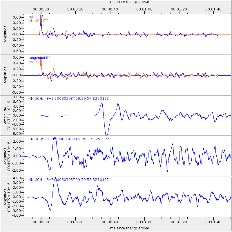
Earthquake location: Kuril Islands
Earthquake latitude/longitude: 46.4/153.2
Earthquake time(UTC): 2008/03/03 (063) 09:31:02 GMT
Earthquake Depth: 10 km
Earthquake Magnitude: 6.2 MB, 6.5 MS, 6.5 MW, 6.5 MW
Earthquake Catalog/Contributor: WHDF/NEIC
Network: KN Kyrgyz Seismic Telemetry Network
Station: UCH KN.UCH
Lat/Lon: 42.23 N/74.51 E
Elevation: 3850 m
Distance: 54.2 deg
Az: 296.174 deg
Baz: 56.734 deg
Ray Param: 0.065573856
Estimated Moho Depth: 52.0 km
Estimated Crust Vp/Vs: 1.85
Assumed Crust Vp: 6.306 km/s
Estimated Crust Vs: 3.418 km/s
Estimated Crust Poisson's Ratio: 0.29
Radial Match: 94.30052 %
Radial Bump: 381
Transverse Match: 78.78477 %
Transverse Bump: 400
SOD ConfigId: 2564
Insert Time: 2010-03-08 21:26:59.226 +0000
GWidth: 2.5
Max Bumps: 400
Tol: 0.001

Signal To Noise

ChannelStoNSTALTA
KN:UCH: :BHN:20080303T09:39:57.325012Z5.6868465.893301E-71.036304E-7
KN:UCH: :BHE:20080303T09:39:57.325012Z9.008438.727664E-79.6883305E-8
KN:UCH: :BHZ:20080303T09:39:57.325012Z19.957881.9157555E-69.5989925E-8
Arrivals
Ps7.3 SECOND
PpPs22 SECOND
PsPs/PpSs30 SECOND