UCH KN.UCH - Earthquake Result Viewer
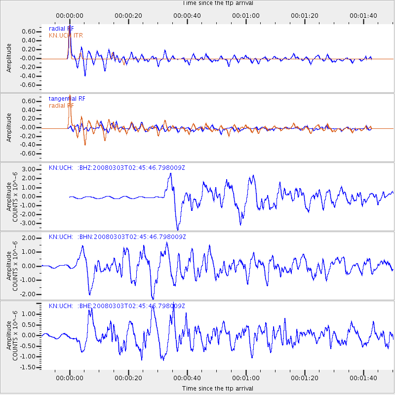
Earthquake location: Southern Sumatra, Indonesia
Earthquake latitude/longitude: -2.2/99.8
Earthquake time(UTC): 2008/03/03 (063) 02:37:27 GMT
Earthquake Depth: 25 km
Earthquake Magnitude: 5.8 MB, 6.1 MS, 6.1 MW, 6.1 MW
Earthquake Catalog/Contributor: WHDF/NEIC
Network: KN Kyrgyz Seismic Telemetry Network
Station: UCH KN.UCH
Lat/Lon: 42.23 N/74.51 E
Elevation: 3850 m
Distance: 49.8 deg
Az: 335.43 deg
Baz: 145.983 deg
Ray Param: 0.06844028
Estimated Moho Depth: 10.25 km
Estimated Crust Vp/Vs: 1.74
Assumed Crust Vp: 6.306 km/s
Estimated Crust Vs: 3.624 km/s
Estimated Crust Poisson's Ratio: 0.25
Radial Match: 94.52643 %
Radial Bump: 400
Transverse Match: 86.89617 %
Transverse Bump: 400
SOD ConfigId: 2564
Insert Time: 2010-03-08 21:27:00.678 +0000
GWidth: 2.5
Max Bumps: 400
Tol: 0.001

Signal To Noise

ChannelStoNSTALTA
KN:UCH: :BHN:20080303T02:45:46.798009Z8.6849246.566652E-77.5609776E-8
KN:UCH: :BHE:20080303T02:45:46.798009Z4.55779273.5304083E-77.745873E-8
KN:UCH: :BHZ:20080303T02:45:46.798009Z12.240471.1835559E-69.669203E-8
Arrivals
Ps1.3 SECOND
PpPs4.2 SECOND
PsPs/PpSs5.5 SECOND