UCH KN.UCH - Earthquake Result Viewer
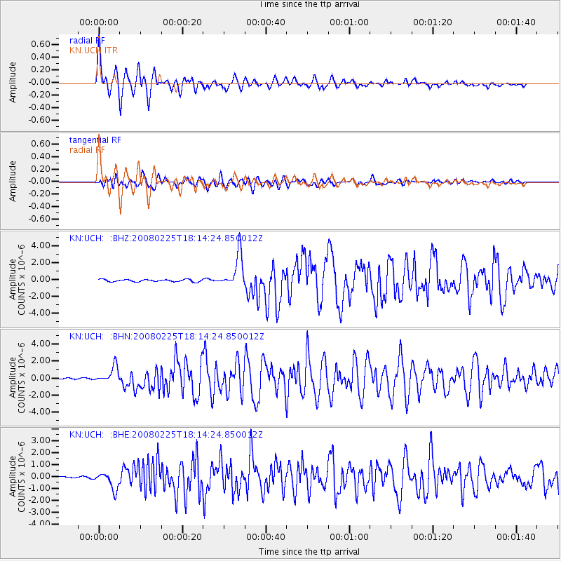
Earthquake location: Southern Sumatra, Indonesia
Earthquake latitude/longitude: -2.3/99.9
Earthquake time(UTC): 2008/02/25 (056) 18:06:03 GMT
Earthquake Depth: 25 km
Earthquake Magnitude: 6.0 MB, 6.4 MS, 6.4 MW, 6.3 MW
Earthquake Catalog/Contributor: WHDF/NEIC
Network: KN Kyrgyz Seismic Telemetry Network
Station: UCH KN.UCH
Lat/Lon: 42.23 N/74.51 E
Elevation: 3850 m
Distance: 50.0 deg
Az: 335.428 deg
Baz: 145.984 deg
Ray Param: 0.0683351
Estimated Moho Depth: 32.5 km
Estimated Crust Vp/Vs: 1.75
Assumed Crust Vp: 6.306 km/s
Estimated Crust Vs: 3.593 km/s
Estimated Crust Poisson's Ratio: 0.26
Radial Match: 95.217285 %
Radial Bump: 400
Transverse Match: 90.38565 %
Transverse Bump: 400
SOD ConfigId: 2564
Insert Time: 2010-03-08 21:27:03.473 +0000
GWidth: 2.5
Max Bumps: 400
Tol: 0.001

Signal To Noise

ChannelStoNSTALTA
KN:UCH: :BHN:20080225T18:14:24.850012Z8.3667589.993413E-71.1944188E-7
KN:UCH: :BHE:20080225T18:14:24.850012Z12.54267.440572E-75.9322407E-8
KN:UCH: :BHZ:20080225T18:14:24.850012Z16.4193522.0786563E-61.2659795E-7
Arrivals
Ps4.1 SECOND
PpPs13 SECOND
PsPs/PpSs18 SECOND