UCH KN.UCH - Earthquake Result Viewer
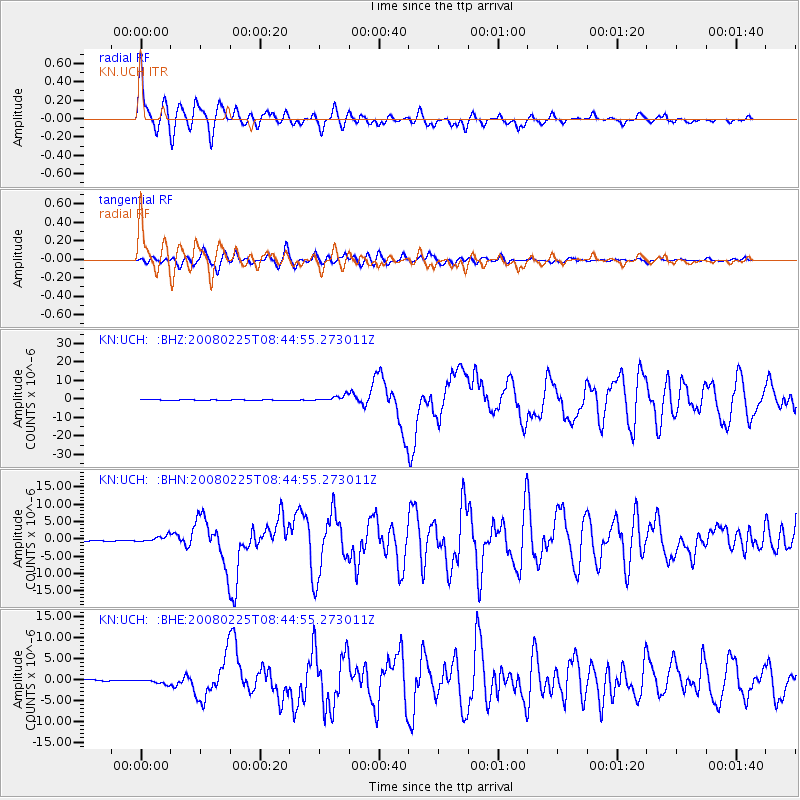
Earthquake location: Southern Sumatra, Indonesia
Earthquake latitude/longitude: -2.5/100.0
Earthquake time(UTC): 2008/02/25 (056) 08:36:33 GMT
Earthquake Depth: 25 km
Earthquake Magnitude: 6.4 MB, 7.3 MS, 7.0 MW, 6.9 MW
Earthquake Catalog/Contributor: WHDF/NEIC
Network: KN Kyrgyz Seismic Telemetry Network
Station: UCH KN.UCH
Lat/Lon: 42.23 N/74.51 E
Elevation: 3850 m
Distance: 50.1 deg
Az: 335.417 deg
Baz: 145.971 deg
Ray Param: 0.06822512
Estimated Moho Depth: 10.5 km
Estimated Crust Vp/Vs: 1.67
Assumed Crust Vp: 6.306 km/s
Estimated Crust Vs: 3.776 km/s
Estimated Crust Poisson's Ratio: 0.22
Radial Match: 95.987076 %
Radial Bump: 400
Transverse Match: 89.69205 %
Transverse Bump: 400
SOD ConfigId: 2564
Insert Time: 2010-03-08 21:27:04.925 +0000
GWidth: 2.5
Max Bumps: 400
Tol: 0.001

Signal To Noise

ChannelStoNSTALTA
KN:UCH: :BHN:20080225T08:44:55.273011Z4.2010448.6477246E-72.0584703E-7
KN:UCH: :BHE:20080225T08:44:55.273011Z4.10868645.2659806E-71.2816702E-7
KN:UCH: :BHZ:20080225T08:44:55.273011Z9.1318751.6717399E-61.8306645E-7
Arrivals
Ps1.2 SECOND
PpPs4.2 SECOND
PsPs/PpSs5.4 SECOND