You are here: Home > Network List > TA - USArray Transportable Network (new EarthScope stations) Stations List
> Station I17K Unalakleet, AK, USA > Earthquake Result Viewer
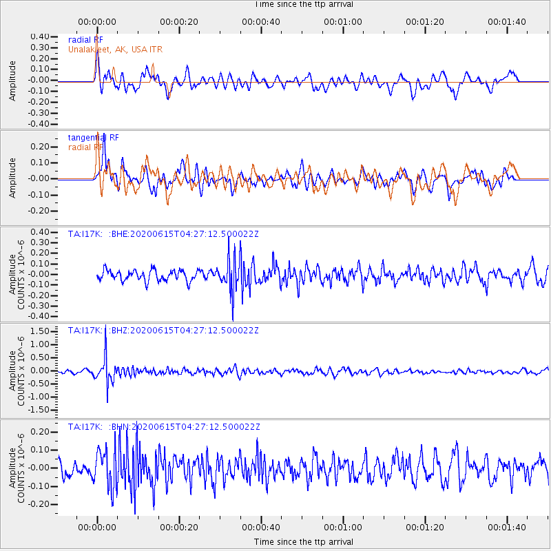
I17K Unalakleet, AK, USA - Earthquake Result Viewer
*The percent match for this event was below the threshold and hence no stack was calculated.
| Earthquake location: |
Halmahera, Indonesia |
| Earthquake latitude/longitude: |
1.3/128.1 |
| Earthquake time(UTC): |
2020/06/15 (167) 04:15:43 GMT |
| Earthquake Depth: |
116 km |
| Earthquake Magnitude: |
5.2 Mww |
| Earthquake Catalog/Contributor: |
NEIC PDE/us |
|
| Network: |
TA USArray Transportable Network (new EarthScope stations) |
| Station: |
I17K Unalakleet, AK, USA |
| Lat/Lon: |
63.89 N/160.70 W |
| Elevation: |
105 m |
|
| Distance: |
80.6 deg |
| Az: |
25.13 deg |
| Baz: |
253.615 deg |
| Ray Param: |
$rayparam |
*The percent match for this event was below the threshold and hence was not used in the summary stack. |
|
| Radial Match: |
69.704765 % |
| Radial Bump: |
400 |
| Transverse Match: |
65.98511 % |
| Transverse Bump: |
400 |
| SOD ConfigId: |
21709731 |
| Insert Time: |
2020-06-29 04:26:20.359 +0000 |
| GWidth: |
2.5 |
| Max Bumps: |
400 |
| Tol: |
0.001 |
|
Signal To Noise
| Channel | StoN | STA | LTA |
| TA:I17K: :BHZ:20200615T04:27:12.500022Z | 8.957371 | 5.0449705E-7 | 5.6322E-8 |
| TA:I17K: :BHN:20200615T04:27:12.500022Z | 1.9988737 | 1.059244E-7 | 5.2992043E-8 |
| TA:I17K: :BHE:20200615T04:27:12.500022Z | 3.0129848 | 1.4900472E-7 | 4.945419E-8 |
| Arrivals |
| Ps | |
| PpPs | |
| PsPs/PpSs | |


