You are here: Home > Network List > US - United States National Seismic Network Stations List
> Station LKWY Lake (Yellowstone--Lake), Wyoming, USA > Earthquake Result Viewer
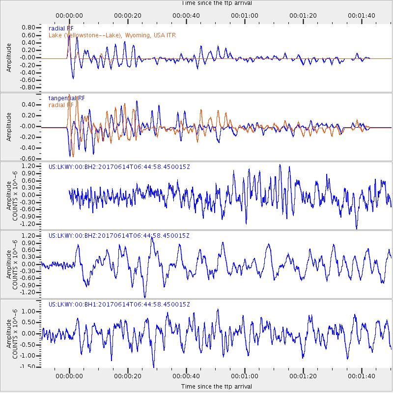
LKWY Lake (Yellowstone--Lake), Wyoming, USA - Earthquake Result Viewer
*The percent match for this event was below the threshold and hence no stack was calculated.
| Earthquake location: |
Near Coast Of Chiapas, Mexico |
| Earthquake latitude/longitude: |
14.2/-93.2 |
| Earthquake time(UTC): |
2017/06/14 (165) 06:38:48 GMT |
| Earthquake Depth: |
11 km |
| Earthquake Magnitude: |
5.5 Mww |
| Earthquake Catalog/Contributor: |
NEIC PDE/us |
|
| Network: |
US United States National Seismic Network |
| Station: |
LKWY Lake (Yellowstone--Lake), Wyoming, USA |
| Lat/Lon: |
44.57 N/110.40 W |
| Elevation: |
2424 m |
|
| Distance: |
33.6 deg |
| Az: |
337.49 deg |
| Baz: |
148.709 deg |
| Ray Param: |
$rayparam |
*The percent match for this event was below the threshold and hence was not used in the summary stack. |
|
| Radial Match: |
65.69684 % |
| Radial Bump: |
400 |
| Transverse Match: |
67.104935 % |
| Transverse Bump: |
400 |
| SOD ConfigId: |
2140511 |
| Insert Time: |
2017-06-27 22:33:09.290 +0000 |
| GWidth: |
2.5 |
| Max Bumps: |
400 |
| Tol: |
0.001 |
|
Signal To Noise
| Channel | StoN | STA | LTA |
| US:LKWY:00:BHZ:20170614T06:44:58.450015Z | 5.0633373 | 3.7111408E-7 | 7.3294366E-8 |
| US:LKWY:00:BH1:20170614T06:44:58.450015Z | 3.0643542 | 4.0551345E-7 | 1.3233243E-7 |
| US:LKWY:00:BH2:20170614T06:44:58.450015Z | 1.2383058 | 2.613967E-7 | 2.1109221E-7 |
| Arrivals |
| Ps | |
| PpPs | |
| PsPs/PpSs | |


