You are here: Home > Network List > TA - USArray Transportable Network (new EarthScope stations) Stations List
> Station R33M Jennings River, BC, CAN > Earthquake Result Viewer
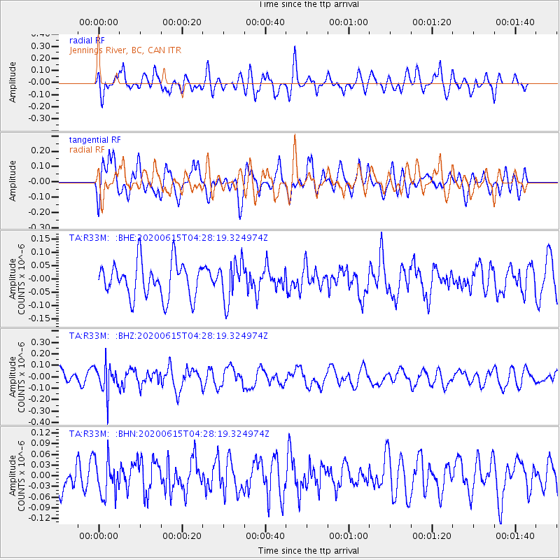
R33M Jennings River, BC, CAN - Earthquake Result Viewer
*The percent match for this event was below the threshold and hence no stack was calculated.
| Earthquake location: |
Halmahera, Indonesia |
| Earthquake latitude/longitude: |
1.3/128.1 |
| Earthquake time(UTC): |
2020/06/15 (167) 04:15:43 GMT |
| Earthquake Depth: |
116 km |
| Earthquake Magnitude: |
5.2 Mww |
| Earthquake Catalog/Contributor: |
NEIC PDE/us |
|
| Network: |
TA USArray Transportable Network (new EarthScope stations) |
| Station: |
R33M Jennings River, BC, CAN |
| Lat/Lon: |
59.39 N/130.97 W |
| Elevation: |
1437 m |
|
| Distance: |
94.5 deg |
| Az: |
30.255 deg |
| Baz: |
280.109 deg |
| Ray Param: |
$rayparam |
*The percent match for this event was below the threshold and hence was not used in the summary stack. |
|
| Radial Match: |
55.94485 % |
| Radial Bump: |
400 |
| Transverse Match: |
57.525402 % |
| Transverse Bump: |
400 |
| SOD ConfigId: |
21709731 |
| Insert Time: |
2020-06-29 04:27:19.652 +0000 |
| GWidth: |
2.5 |
| Max Bumps: |
400 |
| Tol: |
0.001 |
|
Signal To Noise
| Channel | StoN | STA | LTA |
| TA:R33M: :BHZ:20200615T04:28:19.324974Z | 2.2932365 | 1.1989788E-7 | 5.228326E-8 |
| TA:R33M: :BHN:20200615T04:28:19.324974Z | 1.2401549 | 4.9049188E-8 | 3.955086E-8 |
| TA:R33M: :BHE:20200615T04:28:19.324974Z | 1.1617433 | 7.64012E-8 | 6.576427E-8 |
| Arrivals |
| Ps | |
| PpPs | |
| PsPs/PpSs | |


